November 7, 2011
We departed Town Creek Marina @ 0715 hrs bound for Mile Hammock Bay at Mile 244.5 on the ICW. On this particular stretch of the ICW there aren't many places to anchor so most yachts choose Mile Hammock Bay for the first day. This is actually a military basin that is used buy the Marines at Camp Lajeune for maneuvers and training. As long as they aren't conducting live firing exercises, they permit yachts to anchor there. When we arrived, they were having some kind of helicopter exercise that lasted until around 1900 hrs. After that the anchorage fell silent.
We arrived at 1430 hrs and dropped anchor along with our friends on "Auburn Angle", a Tayana 37, who are traveling in the same direction as ourselves. We first met them in Port Colburn and again in Quebec. We traveled together from Quebec to Halifax. Once again we met up in Annapolis, MD and Beaufort, NC. It's a small group of sailors that are heading for the Bahamas or Panama Canal so you keep running into them along the way. There have been about twenty yachts in our rat pack traveling South. The secret to finding good spots at the various anchorages is to weigh anchor and get underway at first light. Nevertheless, everyone seems to find a spot: always room for one more.
We had wanted to sail coastwise to Charleston, SC but there is a subtropical system to the South of Bermuda that is generating strong N'ly winds and seas. The plan is to motor sail to the Cape Fear River in the ICW and see if the Wx moderates. If this happens, we will exit the ICW at Southport, NC and sail to Charleston along the coast. In the meantime, the ICW is quite scenic at this time of year.
Thursday, November 10, 2011

Sunday, November 6, 2011
Trip to visit friends in Ocean Springs.Family in Shreveport, and Flat Leigha
 |
| Our good friends Deloris & Scott |
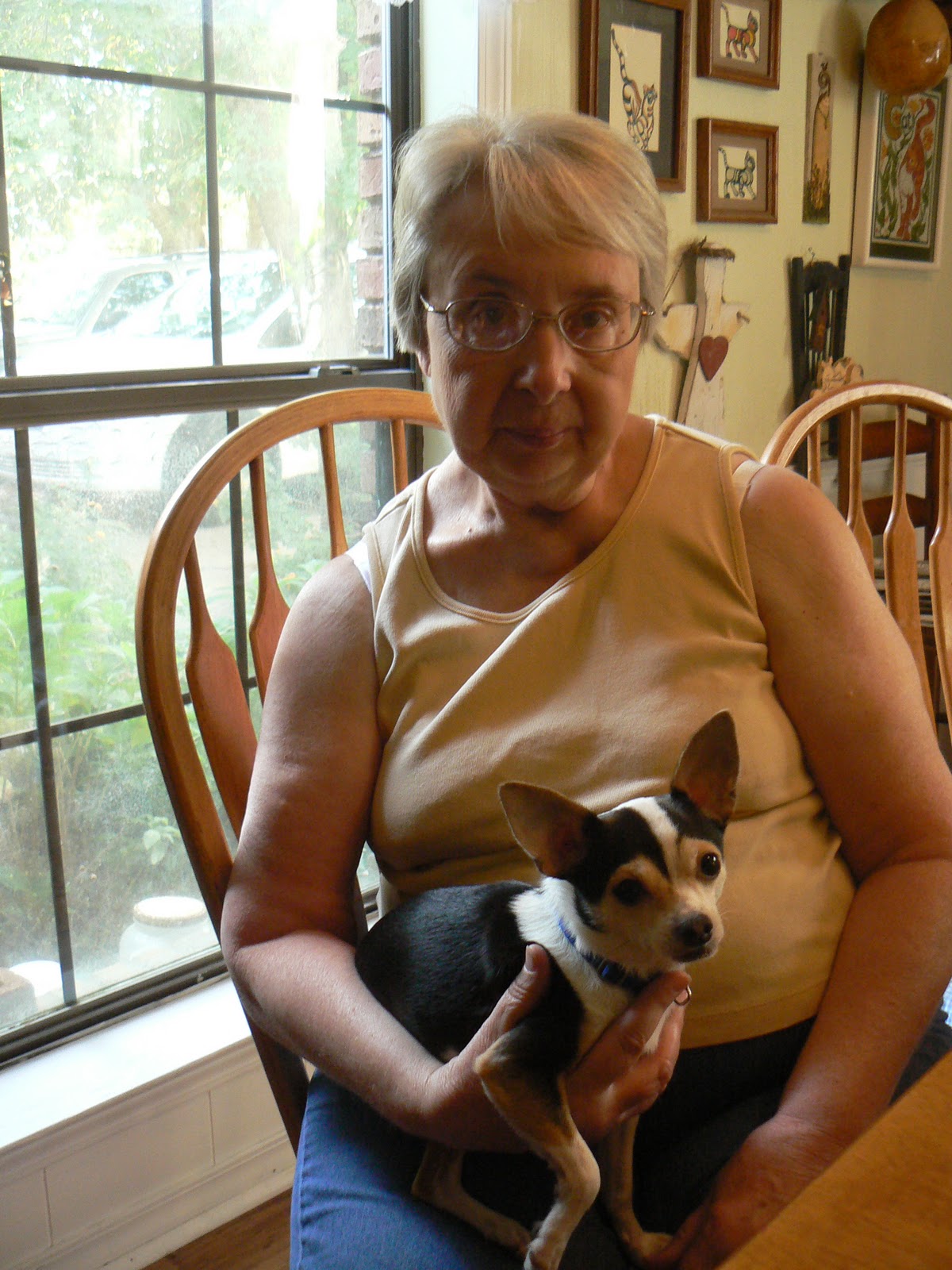 |
| Deloris & her dog Petee |
 |
| Deloris & Phyllis |
 |
| Lisa & Andy more good friends |
 |
| Having a good time with friends |
 |
| Grand-daughter Payton age 7 |
 |
| Grandson Parker age 19 months |
 |
| Daugther Samantha & son-law Louis |
 |
| Getting ready to go into the corn maze with grand-kids |
 |
| Flat Leigha as Scare crow |
 |
| Payton & Flat Leigha |
 |
| Flat Leigha out at sea with Don & Phyllis |
 |
| Helping Don with helming |
 |
| Flat Leigha helping with the anchor |
 |
| Flat Leigha resting after a long day at with her step grand parents Phyllis & Don |
ORIENTAL, NC TO BEAUFORT, NC (25 MILES)
November 6, 2011
The N'ly wind has diminished somewhat but still has strength to it. The Wx forecast for the next several days is wind from the N- NE 15-25 with seas running 5-8 ft. This is more than we want to deal with so we will motor sail to Cape Fear and try to exit there. Once we are there we'll be on the other side of Frying Pan Shoal and able to run along the coast to Charleston, SC.
Departed Oriental this morning at 0800 hrs. The run from Oriental to Beaufort is only 25 miles. With a N'ly wind and favorable ebb current, we were making 8.0 kts down the ICW. Our destination today is Town Creek Marina. The current is very strong in Beaufort/Morehead City and the holding is poor according to the pilot guides. Also, I want to take on fuel for the trip to down the ICW.
Beaufort, NC has a reputation for being quite charming, however, we won't get a chance to see it. We have to make time going South. It's getting cold down here. Tomorrow we will motor sail to an anchorage off the ICW at Mile 245 called Mile Hammock Bay. Essentially, it is a basin dredged out by the military for use with Camp LeJeune. A very popular place with the migrating southern hoard. There aren't too many places to anchor on this stretch of the ICW. Town Creek marina is at Mile 201 and Southport on the entrance to the Cape Fear River is Mile 309. It will take us two plus days to make this mileage. I would like to be at Southport in the AM on November 9th. Have to see how this plays out.
The N'ly wind has diminished somewhat but still has strength to it. The Wx forecast for the next several days is wind from the N- NE 15-25 with seas running 5-8 ft. This is more than we want to deal with so we will motor sail to Cape Fear and try to exit there. Once we are there we'll be on the other side of Frying Pan Shoal and able to run along the coast to Charleston, SC.
Departed Oriental this morning at 0800 hrs. The run from Oriental to Beaufort is only 25 miles. With a N'ly wind and favorable ebb current, we were making 8.0 kts down the ICW. Our destination today is Town Creek Marina. The current is very strong in Beaufort/Morehead City and the holding is poor according to the pilot guides. Also, I want to take on fuel for the trip to down the ICW.
Beaufort, NC has a reputation for being quite charming, however, we won't get a chance to see it. We have to make time going South. It's getting cold down here. Tomorrow we will motor sail to an anchorage off the ICW at Mile 245 called Mile Hammock Bay. Essentially, it is a basin dredged out by the military for use with Camp LeJeune. A very popular place with the migrating southern hoard. There aren't too many places to anchor on this stretch of the ICW. Town Creek marina is at Mile 201 and Southport on the entrance to the Cape Fear River is Mile 309. It will take us two plus days to make this mileage. I would like to be at Southport in the AM on November 9th. Have to see how this plays out.
Saturday, November 5, 2011
BROAD CREEK ANCHORAGE TO ORIENTAL, NC
November 2, 2011
A beautiful morning with a persistent North wind. There was no need to get U/W early so we didn't weigh anchor until 0912 hrs. We only have nine miles to Oriental. There are two other Valiants behind us and I have asked them where they are going to berth in Oriental. It appears that Seacraft Services with allow yachts to raft up to another boat for $30 per day with shore power. That is the cheapest marina we have found.
So in we go to Whitaker Creek and raft alongside another Valiant at 1115 hrs. Oriental is a yachting mecca and many yachts call it "home". It is a quaint little town built around fishing and yachts. The locals are all knowledgeable in seafaring matters and very friendly. It is pleasant to walk around and see the shops and people. We have a severe Wx warning given by NOAA and the USCG for gale force winds extending from Cape Hatteras to Cape Fear. We'll be here a few days!
November 3, 2011 Thursday
We have used today to organize and set up our Monitor Wind. This apparatus will self steer the boat using only wind power. It is on the transom of "Solstice" and hasn't been used in many years but is in good condition. I'm putting new lines it and getting it ready for the long Atlantic and Pacific crossings. Additionally, we have an auto pilot which will steer the boat using DC power. Between the two units, Phyllis and I won't be slaves to the helm. This gives us time to accomplish other navigational tasks.
There are six Valiants here at this Marina. That means a whole lot of info can be collected. One of the Valiant owners on "Tamure" is a two time circumnavigator. He and his wife did their first circumnavigation in the early 80's. Then they took their two children on another circumnavigation and home schooled them aboard. How many children get that opportunity??
Gale and Storm Warnings Up for 45-50 kt winds. Not going anywhere.
November 4, 20011
The wind is howling outside at 45-50 kts. Reports offshore indicate wave height in excess of 15' out to 20 nm and then 25' beyond that.
Scott and Kitty Kuhner from "Tamure" have been very kind to invite us over to their boat for talk and drinks. Scott has spent a good part of his time downloading the navigation programs onto our laptop that will take us to the end of the world. For the first time, we are now in the cruising world that is moving South to the Bahamas, Caribbean and South Pacific. The amount of knowledge and experience that exists in this transient cruising world is staggering.
November 5, 2011 Saturday
Gale and Storm warnings continue. We continue to meet other cruizers. Tonight Scott and Kitty from "Tamure" gave a slide show of their circumnavigation with their two boys who were 9 & 11 years old at the time. They were home schooled aboard the yacht and have had a unique education that few ever get.
We will leave Oriental tomorrow and go to Beaufort, NC which is only 25 miles from here. It appears that we will have to continue in the ICW to Cape Fear and try to come out at Southport, NC on the mouth of the Cape Fear River. The Wx isn't moderating and we are anxious to make time. It has been a very rewarding experience to be here in Oriental with those that that have been there before. Everyone is willing to give and be helpful knowing that the day will come when, they too, will need help.
A beautiful morning with a persistent North wind. There was no need to get U/W early so we didn't weigh anchor until 0912 hrs. We only have nine miles to Oriental. There are two other Valiants behind us and I have asked them where they are going to berth in Oriental. It appears that Seacraft Services with allow yachts to raft up to another boat for $30 per day with shore power. That is the cheapest marina we have found.
So in we go to Whitaker Creek and raft alongside another Valiant at 1115 hrs. Oriental is a yachting mecca and many yachts call it "home". It is a quaint little town built around fishing and yachts. The locals are all knowledgeable in seafaring matters and very friendly. It is pleasant to walk around and see the shops and people. We have a severe Wx warning given by NOAA and the USCG for gale force winds extending from Cape Hatteras to Cape Fear. We'll be here a few days!
November 3, 2011 Thursday
We have used today to organize and set up our Monitor Wind. This apparatus will self steer the boat using only wind power. It is on the transom of "Solstice" and hasn't been used in many years but is in good condition. I'm putting new lines it and getting it ready for the long Atlantic and Pacific crossings. Additionally, we have an auto pilot which will steer the boat using DC power. Between the two units, Phyllis and I won't be slaves to the helm. This gives us time to accomplish other navigational tasks.
There are six Valiants here at this Marina. That means a whole lot of info can be collected. One of the Valiant owners on "Tamure" is a two time circumnavigator. He and his wife did their first circumnavigation in the early 80's. Then they took their two children on another circumnavigation and home schooled them aboard. How many children get that opportunity??
Gale and Storm Warnings Up for 45-50 kt winds. Not going anywhere.
November 4, 20011
The wind is howling outside at 45-50 kts. Reports offshore indicate wave height in excess of 15' out to 20 nm and then 25' beyond that.
Scott and Kitty Kuhner from "Tamure" have been very kind to invite us over to their boat for talk and drinks. Scott has spent a good part of his time downloading the navigation programs onto our laptop that will take us to the end of the world. For the first time, we are now in the cruising world that is moving South to the Bahamas, Caribbean and South Pacific. The amount of knowledge and experience that exists in this transient cruising world is staggering.
November 5, 2011 Saturday
Gale and Storm warnings continue. We continue to meet other cruizers. Tonight Scott and Kitty from "Tamure" gave a slide show of their circumnavigation with their two boys who were 9 & 11 years old at the time. They were home schooled aboard the yacht and have had a unique education that few ever get.
We will leave Oriental tomorrow and go to Beaufort, NC which is only 25 miles from here. It appears that we will have to continue in the ICW to Cape Fear and try to come out at Southport, NC on the mouth of the Cape Fear River. The Wx isn't moderating and we are anxious to make time. It has been a very rewarding experience to be here in Oriental with those that that have been there before. Everyone is willing to give and be helpful knowing that the day will come when, they too, will need help.
PUNGO CREEK TO BROAD CREEK ANCHORAGE (37 MILES)
November 1, 2011 Tuesday
It blew quite hard last night out of the North but our 45 lb Manson Supreme anchor didn't give up an inch. The quality of the bottom is made up of sand and mud which is great holding matter. We set the anchor alarm on the GPS unit and went to sleep. If we drag outside of a 200 ft radius, the anchor alarm will sound and wake us up. How wonderful is modern technology is so many ways.
Weigh anchor and get under way at 0810 hrs for Broad Creek anchorage (35 deg. 05.4' N x 76 deg. 36.7' W). The distance is 37 miles. We are moving slower at this point in time because there are unfavorable Wx forecasts for making it to Beaufort, NC and then trying to sail coast wise. Broad Creek is only 9 miles from Oriental, NC which is the registered home port for "Solstice". If we anchor in Broad Creek tonight and get an early start tomorrow, we'll beat the next Southbound Hoard coming down from Belhaven which is 51 miles North of us. In the meantime, the yachts occupying the slips in Oriental will get U/W and leave us with a better opportunity to find a cheap berth.
We dropped the hook in Broad Creek at 1430 hrs and enjoyed a quiet peaceful afternoon. These creeks are quite remote and we haven't had cell phone service or internet since Coinjock, NC
It blew quite hard last night out of the North but our 45 lb Manson Supreme anchor didn't give up an inch. The quality of the bottom is made up of sand and mud which is great holding matter. We set the anchor alarm on the GPS unit and went to sleep. If we drag outside of a 200 ft radius, the anchor alarm will sound and wake us up. How wonderful is modern technology is so many ways.
Weigh anchor and get under way at 0810 hrs for Broad Creek anchorage (35 deg. 05.4' N x 76 deg. 36.7' W). The distance is 37 miles. We are moving slower at this point in time because there are unfavorable Wx forecasts for making it to Beaufort, NC and then trying to sail coast wise. Broad Creek is only 9 miles from Oriental, NC which is the registered home port for "Solstice". If we anchor in Broad Creek tonight and get an early start tomorrow, we'll beat the next Southbound Hoard coming down from Belhaven which is 51 miles North of us. In the meantime, the yachts occupying the slips in Oriental will get U/W and leave us with a better opportunity to find a cheap berth.
We dropped the hook in Broad Creek at 1430 hrs and enjoyed a quiet peaceful afternoon. These creeks are quite remote and we haven't had cell phone service or internet since Coinjock, NC
BEAR POINT ANCHORAGE TO PUNGO CREEK ANCHORAGE (34 MILES)
October 31, 2011
Today is the magic day for all cruisers heading South. Most insurance policies stipulate that recreational vessels can not be South of 35 degrees North during the active tropical season. Cape Hatteras is located at 35 degrees North. Now the pace will quicken for the general hoard moving South. For the most part the big mega yachts are courteous and slow down while passing, however, there are a few that exude money, arrogance and ignorance in the boating world. They have a total disregard for everyone and anything outside their luxurious power yachts.
We anchored in Pungo Creek (35 deg 30.4' N x 76 39.2' W) at 1415hrs and set out 60 ft of chain in 10 ft of water. The winds are predicted to blow very strongly tonight out of the North. The creeks that I choose are very well protected and carry adequate depth for our draft. We draw 6 ft so I won't anchor in anything less that 7 ft at MLLW (mean lower low water). The entrance to the creeks are marked with day markers so and are on the charts so navigation isn't difficult. Additionally, there are guides that recommend certain anchorages. There was a colorful sunset this evening.
Today is the magic day for all cruisers heading South. Most insurance policies stipulate that recreational vessels can not be South of 35 degrees North during the active tropical season. Cape Hatteras is located at 35 degrees North. Now the pace will quicken for the general hoard moving South. For the most part the big mega yachts are courteous and slow down while passing, however, there are a few that exude money, arrogance and ignorance in the boating world. They have a total disregard for everyone and anything outside their luxurious power yachts.
We anchored in Pungo Creek (35 deg 30.4' N x 76 39.2' W) at 1415hrs and set out 60 ft of chain in 10 ft of water. The winds are predicted to blow very strongly tonight out of the North. The creeks that I choose are very well protected and carry adequate depth for our draft. We draw 6 ft so I won't anchor in anything less that 7 ft at MLLW (mean lower low water). The entrance to the creeks are marked with day markers so and are on the charts so navigation isn't difficult. Additionally, there are guides that recommend certain anchorages. There was a colorful sunset this evening.
COINJOCK, NC TO ANCHORAGE AT BEAR POINT (52 MILES)
Oct 30, 2011
We spent an extra day in Coinjock due to gale force winds posted for Albermarle Sound. When we woke up this morning there was ice on the dock! We are moving into a transitional period when there are stronger cold fronts coming through the area. Last night it was blowing 35 kts and gusting even higher. There is a swing bridge on the Alligator River that we have to go through and they don't open in winds that are blowing higher than 34 miles per hour. The winds have been out of the North for the last several days. These are favorable for us because we can set out the jib while motoring. This gives us an extra one to one and a half knots. I figure that we can motor along at 5.5 to 6.0 kts. With the jib set and drawing, we'll make 6.8 to 7.1 kts.
We departed the dock at 0715 and dropped anchor at Bear Point (35 deg. 40.4' N x 76 deg 03.5' W) at 1500 hrs. The distance was 52 miles so we made an average speed of 6.9 miles per hour. Distance on the Intracoastal Waterway is measured in statute miles rather than the traditional nautical miles used at sea. The nautical mile is longer. The distances I am posting for the ICW are statute miles
There is an unbelievable hoard of boats heading South for the winter. At the Bear Point Anchorage we had about 20 vessels anchored. the Wx was good and fell to almost calm during the night. Water depth was around 10 ft so I paid out 60 ft of chain which gave me a scope of 6:1. The recommended scope for anchoring is at least 5:1 and can go as high as 9:1 if Wx conditions are stormy.
We spent an extra day in Coinjock due to gale force winds posted for Albermarle Sound. When we woke up this morning there was ice on the dock! We are moving into a transitional period when there are stronger cold fronts coming through the area. Last night it was blowing 35 kts and gusting even higher. There is a swing bridge on the Alligator River that we have to go through and they don't open in winds that are blowing higher than 34 miles per hour. The winds have been out of the North for the last several days. These are favorable for us because we can set out the jib while motoring. This gives us an extra one to one and a half knots. I figure that we can motor along at 5.5 to 6.0 kts. With the jib set and drawing, we'll make 6.8 to 7.1 kts.
We departed the dock at 0715 and dropped anchor at Bear Point (35 deg. 40.4' N x 76 deg 03.5' W) at 1500 hrs. The distance was 52 miles so we made an average speed of 6.9 miles per hour. Distance on the Intracoastal Waterway is measured in statute miles rather than the traditional nautical miles used at sea. The nautical mile is longer. The distances I am posting for the ICW are statute miles
There is an unbelievable hoard of boats heading South for the winter. At the Bear Point Anchorage we had about 20 vessels anchored. the Wx was good and fell to almost calm during the night. Water depth was around 10 ft so I paid out 60 ft of chain which gave me a scope of 6:1. The recommended scope for anchoring is at least 5:1 and can go as high as 9:1 if Wx conditions are stormy.
Subscribe to:
Posts (Atom)