May 26-31,2014
We have had very light winds on our trip North. We anchored in Pancake Creek (24-00.6' S x 151-44.2' E) at 1230 hrs. We had just enough wind at the right angle to sail into the anchorage. It is a beautiful place and quite isolated with only a few make-shift fishermans' tents on the beach. We were able to watch them set out nets and bring them in as has been done for thousands of years. Just small schools of fish but they must have a market value. I like to see traditional fishing where no big environmental impact is done.
We stayed in Pancake Creek for two days while the Trade Winds settled down and then took off on Wednesday May 28th at 1200 hrs for Great Keppel Island which is 70 nm to the Northwest. The winds were light from the E-SE and eventually veered into the SW during the late evening. By 1800 hrs we were becalmed just North of Gladstone's big ship anchorages so we took in the jib and lay hove-to waiting on wind.
May 29th - still waiting on wind which, finally, came along at 0300 hrs in the morning out of the SE at 5 kts; not much but enough to make way at about 2.5 kts. The tidal currents in this area set South on the Flood and North on the Ebb at about 1.0 kt. Winds continued light and seas at lest than 2' so sailing was pleasant. The wind was forecast to increase later in the evening so we continued on to Great Keppel Island and made a nightfall landing at Leeke's Beach on the Northern part of the island. The anchorage is quite rolly and not comfortable but the Trades are blowing 20-25 and sending a swell around the headland which has us bouncing around. On Sunday, the forecast is for them to diminish and we'll sail over to Rosslyn Bay Marina and see if we can buy a few groceries. The only thing we could use will be green vegetables and fruit. The big problem in Australia is that the marinas have a requirement that yachts carry a 10 million dollar third party insurance policy. If you don't have it, they may not let you stay there. I tried to get this in Manly, AU but was told that only Australian registered boats were accepted. Fortunately, East Coast Marina never asked me for it. We''' see what happens at Great Keppel Marina in Rosslyn Bay which is only about 8 nm from where we are anchored. Our first muster point is at Abel Point Marina in Airlie Beach and they have agreed to wave the 10 mil insurance and cover it themselves.
So much for now.
Friday, May 30, 2014

Tuesday, May 27, 2014
GOING NORTH - UP THE QUEENSLAND EAST COAST
May 20-28, 2014
We left our berth at East Coast Marina in Manly, AU at 1000 hrs on Tuesday May 20th for Abell Point Marina located at Airlie Beach - 650 nm North. The wind was light from the SE at less that 10 kts but we were able to sail slowly out of Moreton Bay. By 1330 hrs the wind has petered out so we had to start motoring. The Ship channel leading into Brisbane is over 30 nm and winds its way around many shoals. The flood and ebb tides run quite strongly - 3-4 kts in places. It's important to use them to advantage. The flood sets south and the ebb goes north. Since we're going North, we used the ebb to advantage.
Our first destination was The Great Sandy Strait with an entrance at Wide Bay Bar. It's about 80 nm up the Coral Coast and offers a calm-water passage of Fraser Island rather than the sea passage outside. Wide Bay Bar (28-48.5' S x 153-07.7' E) is called the "Mad Mile" because it has sand shoals on both sides of the entrance channel that has waves constantly breaking over them. There is a direction light and leads but a flood tide should be used to cut down on the turbulence. It's quite disconcerting to be navigating through the entrance with big waves crashing all around. The way we navigate these restricted channels is that Phyllis is at the helm and I am using a navigational charting program, charts and eyeball to confirm that we are in the channel. I give the helm orders to Phyllis: She is becoming a very good helmswoman. We have added a new navigational program on our Ipad so that she can see everything unfolding at the helm and I have the main laptop with another navigational program running below. This seems to work out fine as we have wiggled through many narrow places.
Once inside the Great Sandy Strait, there are many places to anchor in perfectly calm and protected conditions. We chose "Gray's Anchorage" (25-37.9' S x 152-58.3' E) as out first night's stop. In order to exit the Great Sandy Strait into Hervey Bay in the North, a flood tide has to be used that is a little more than the draft of the boat. Our draft is 6' so we look for at least 7' of underwater clearance. The flood tide for the day was at 1630 hrs with 8.5 ft over Boonlye Pt - the shallowest part of the strait. We departed Gary's Anchorage at 1345 and slowly motored the 8 miles to Boonlye point. In Australia, many of the river bars have to be negotiated using tides as there just issn't enough water to get over them. Once over the bar there is enough water to accommodate the draft. There are some river bars that dry out at Spring Tides so timing the Tides is crucial to getting over them.
Anyway, after crossing over Boonlye Pt and Sheridan Flats, we found a snug anchorage at White Sand Cliffs (25-31.7' S x 152-57.9' E). Most of these anchorages are quite scenic and offer the possibility to explore creeks and places ashore. Fraser's Island is the largest sandy island in the world but is heavily forested. It is a World Heritage Site and very beautiful along the western shore. One could spend weeks exploring all that is offered by the National Park Service. Our goal was to continue north so we weighed anchor the following morning and headed for Bundaberg (24-45.4' S x 152-29.0' E) which is about 30 nm north of the Fairway Buoy at the northern entrance of the Great Sandy Strait. We had motored quite a bit so I wanted to top up on fuel and water. Bundaberg is a major port on the Coral Coast and is famous for its rum. It is an area where sugar cane is king so vessels from other parts of the South Pacific call to load sugar and rum. Disgracefully, in the not too distant past, it used "blackbirding" and slavery to work the cane fields. South Pacific Islanders were enticed and kidnapped from their villages and taken to the Queesland Coast to perform those tasks which enriched their white masters. The Queenslanders were a ruthless lot and looked upon the aborigines and darker skinned peoples as less than human. The "white only" Australian policy persisted right up into the 1970's. Looking at the racial makeup of Australia today, it hard to believe how quickly that was reversed once the doors were opened to SE Asian and Pacific Island immigration.
Bundaberg was a quick stop. We fueled and took on water and left within an hour. Our next destination was Pancake Creek (24-00.6' S x 151-44.2' E) about 60 nm North of Bundaberg. We arrived on Monday May 26th and dropped anchor at 1230 hrs in a very lovely creek that is sheltered from the prevailing E-SE winds. I am composing this as we sit here on anchor. We will sail today for either Hummocky Is (23-24.0' S x 151-09.4' E) or Great Keppel Island (23-09.8' S x 150-57.1' E). The islands are part of the Capricorn Group and we are now beginning to enter the Great Barrier Reef System which continues another 800 nm up the coast to Thursday Is. Hummocky is about 48 nm from us and Great Keppel Reef some 67 nm. We will make another overnight sail and choose one or the other. After this, most of the sailing will be done during the day and anchoring at night. Our goal is to be at Abell Point Marina at Airlie Beach (20-15.8' S x 148-42.7' E) by June 10th. We have plenty of time to visit many of the islands in the Great Barrier Reef before getting there. Will update as time and internet availability allow.
We left our berth at East Coast Marina in Manly, AU at 1000 hrs on Tuesday May 20th for Abell Point Marina located at Airlie Beach - 650 nm North. The wind was light from the SE at less that 10 kts but we were able to sail slowly out of Moreton Bay. By 1330 hrs the wind has petered out so we had to start motoring. The Ship channel leading into Brisbane is over 30 nm and winds its way around many shoals. The flood and ebb tides run quite strongly - 3-4 kts in places. It's important to use them to advantage. The flood sets south and the ebb goes north. Since we're going North, we used the ebb to advantage.
Our first destination was The Great Sandy Strait with an entrance at Wide Bay Bar. It's about 80 nm up the Coral Coast and offers a calm-water passage of Fraser Island rather than the sea passage outside. Wide Bay Bar (28-48.5' S x 153-07.7' E) is called the "Mad Mile" because it has sand shoals on both sides of the entrance channel that has waves constantly breaking over them. There is a direction light and leads but a flood tide should be used to cut down on the turbulence. It's quite disconcerting to be navigating through the entrance with big waves crashing all around. The way we navigate these restricted channels is that Phyllis is at the helm and I am using a navigational charting program, charts and eyeball to confirm that we are in the channel. I give the helm orders to Phyllis: She is becoming a very good helmswoman. We have added a new navigational program on our Ipad so that she can see everything unfolding at the helm and I have the main laptop with another navigational program running below. This seems to work out fine as we have wiggled through many narrow places.
Once inside the Great Sandy Strait, there are many places to anchor in perfectly calm and protected conditions. We chose "Gray's Anchorage" (25-37.9' S x 152-58.3' E) as out first night's stop. In order to exit the Great Sandy Strait into Hervey Bay in the North, a flood tide has to be used that is a little more than the draft of the boat. Our draft is 6' so we look for at least 7' of underwater clearance. The flood tide for the day was at 1630 hrs with 8.5 ft over Boonlye Pt - the shallowest part of the strait. We departed Gary's Anchorage at 1345 and slowly motored the 8 miles to Boonlye point. In Australia, many of the river bars have to be negotiated using tides as there just issn't enough water to get over them. Once over the bar there is enough water to accommodate the draft. There are some river bars that dry out at Spring Tides so timing the Tides is crucial to getting over them.
Anyway, after crossing over Boonlye Pt and Sheridan Flats, we found a snug anchorage at White Sand Cliffs (25-31.7' S x 152-57.9' E). Most of these anchorages are quite scenic and offer the possibility to explore creeks and places ashore. Fraser's Island is the largest sandy island in the world but is heavily forested. It is a World Heritage Site and very beautiful along the western shore. One could spend weeks exploring all that is offered by the National Park Service. Our goal was to continue north so we weighed anchor the following morning and headed for Bundaberg (24-45.4' S x 152-29.0' E) which is about 30 nm north of the Fairway Buoy at the northern entrance of the Great Sandy Strait. We had motored quite a bit so I wanted to top up on fuel and water. Bundaberg is a major port on the Coral Coast and is famous for its rum. It is an area where sugar cane is king so vessels from other parts of the South Pacific call to load sugar and rum. Disgracefully, in the not too distant past, it used "blackbirding" and slavery to work the cane fields. South Pacific Islanders were enticed and kidnapped from their villages and taken to the Queesland Coast to perform those tasks which enriched their white masters. The Queenslanders were a ruthless lot and looked upon the aborigines and darker skinned peoples as less than human. The "white only" Australian policy persisted right up into the 1970's. Looking at the racial makeup of Australia today, it hard to believe how quickly that was reversed once the doors were opened to SE Asian and Pacific Island immigration.
Bundaberg was a quick stop. We fueled and took on water and left within an hour. Our next destination was Pancake Creek (24-00.6' S x 151-44.2' E) about 60 nm North of Bundaberg. We arrived on Monday May 26th and dropped anchor at 1230 hrs in a very lovely creek that is sheltered from the prevailing E-SE winds. I am composing this as we sit here on anchor. We will sail today for either Hummocky Is (23-24.0' S x 151-09.4' E) or Great Keppel Island (23-09.8' S x 150-57.1' E). The islands are part of the Capricorn Group and we are now beginning to enter the Great Barrier Reef System which continues another 800 nm up the coast to Thursday Is. Hummocky is about 48 nm from us and Great Keppel Reef some 67 nm. We will make another overnight sail and choose one or the other. After this, most of the sailing will be done during the day and anchoring at night. Our goal is to be at Abell Point Marina at Airlie Beach (20-15.8' S x 148-42.7' E) by June 10th. We have plenty of time to visit many of the islands in the Great Barrier Reef before getting there. Will update as time and internet availability allow.
Thursday, May 15, 2014
Back to the States
Here are pictures of our children and family.
 |
| Christmas day we drove to Asheville NC to visit our other daughters Misty and Tiffany. Unfortunately Tiffany was working so she is not in this picture. We have the two sisters, Misty , Samantha and Parker, waiting to be seated at the restaurant. |
 |
| Father and daughter. |
 |
| This is the Ouellette family in visiting our brother Val. |
 |
| Every year in March they get together and treat Val to Chicken stew and ployes a french pancake which Maureen makes ahead. It is the biggest treat for Val. So here Maureen is serving up the stew. then we all get to visit and reminisce. |
 |
| Then of to Nashville, TN for our oldest daughter Samantha's graduation for her Masters. What a proud moment for all her hard work , working full time and full time mom. |
 |
| Proud parents. |
 |
| Mom with her two children, Parker 4 and Payton 9. |
 |
| Payton. |
 |
| Parker |
 |
| Aunt Misty and Payton |
 |
| Aunt Tiffany and Payton |
 |
| Memere Phyllis, grand daughter Payton, and daughter Misty. |
 |
| Tiffany and Misty. |
It was great being all together with the girls and grand kids for Sam's graduation.
BACK IN AUSTRAILIA
May 15, 2014
"Nanaste" to our family, friends and sailing acquaintances, some of which have, indeed, become very good friends. In a book co-authored by Peter Mathiessen titled "Lo Mothang". he gives a beautiful translation of the Hindu word "Nanaste" as follows: "I honor the place in you that is light-filled and universal, where if you are in that place in you and I am in that place in me, there is only one of us."
We left Manly, AU for the USA on December 7th and returned on April 17th. We would have liked to visit more family and friends, however, on our annual pilgrimage to Ocean Springs, MS for medical, dental and and eye check ups, it was discovered that Phyllis had developed a "macular hole" in her left eye. The retinal specialist recommended a surgical procedure that gave us no choice to continue traveling until that was successfully completed. During the operation, the cataract that was on the eye worsened which required another surgical procedure. All this limited our time and mobility to visit those of you that we had so wanted to see. In the end, Phyllis is doing fine and is able to see as well as can be expected. There was a time during all this when I thought I was going to have to return to Australia alone and take "Solstice" single-handed to northern Queensland.
On April 20th, we motored out to "Little Sands" in Moreton Bay. There was no wind and the bay was very calm. We anchored overnight off a beautiful beach and did some exploring the following day with our friends Bruce and Marcelle from "Adventure Bound". Later in the afternoon on the folloing day, we returned to our berth at East Coast Marina in Manly, AU. It was a good shake-down trip and everything was working perfectly.
This will be a an intensive cruising season. We will leave East Coast Marina on May 20th and sail north to Airlie Beach on the north Queensland Coast to meet up with the Sail2Indonesia Rally that will arrive there on June 14th. We have not sailed with a group before but this one offers so many perks in the Indonesian theater that it was difficult not to do it. The plan is to sail to Thursday Is off the York peninsula and check out there for Saumlaki, Indonesia on July 23rd. A lot depends on weather and unexpected delays. We will be sailing up the Indonesian archipelago for almost four months. Check out date for Singapore is November 27. Once in Singapore, we will continue on to Western Malaysia and Thailand. We should arrive in Phuket, Thailand at the beginning of next year. Once in Thailand,we'll have a lot of work to do to get the boat ready for the most challenging part of this circumnavigation - South Africa.
I will make a good effort to update the blog as we move along but much depends on the internet connections that are available. For the immediate future, once we depart Manly, AU we'll sail north to Wide Bay and the Great Sandy Strait - 110 nm. From there we'll continue on to Bundburg, AU and the beginning of the Great Barrier Reef. All navigation will be on the inside of the reef. The further north one goes, the narrower it gets and more reefs appear. They are well marked but most sailing is done during the day with anchoring at night. I have made a thorough study of the area and am looking forward to seeing all that I have read about.
The SE Trade Winds are becoming well established. The further north we go the stronger they become but the Great Barrier Reef cuts down the swell and seas.
"Nanaste" to our family, friends and sailing acquaintances, some of which have, indeed, become very good friends. In a book co-authored by Peter Mathiessen titled "Lo Mothang". he gives a beautiful translation of the Hindu word "Nanaste" as follows: "I honor the place in you that is light-filled and universal, where if you are in that place in you and I am in that place in me, there is only one of us."
We left Manly, AU for the USA on December 7th and returned on April 17th. We would have liked to visit more family and friends, however, on our annual pilgrimage to Ocean Springs, MS for medical, dental and and eye check ups, it was discovered that Phyllis had developed a "macular hole" in her left eye. The retinal specialist recommended a surgical procedure that gave us no choice to continue traveling until that was successfully completed. During the operation, the cataract that was on the eye worsened which required another surgical procedure. All this limited our time and mobility to visit those of you that we had so wanted to see. In the end, Phyllis is doing fine and is able to see as well as can be expected. There was a time during all this when I thought I was going to have to return to Australia alone and take "Solstice" single-handed to northern Queensland.
On April 20th, we motored out to "Little Sands" in Moreton Bay. There was no wind and the bay was very calm. We anchored overnight off a beautiful beach and did some exploring the following day with our friends Bruce and Marcelle from "Adventure Bound". Later in the afternoon on the folloing day, we returned to our berth at East Coast Marina in Manly, AU. It was a good shake-down trip and everything was working perfectly.
This will be a an intensive cruising season. We will leave East Coast Marina on May 20th and sail north to Airlie Beach on the north Queensland Coast to meet up with the Sail2Indonesia Rally that will arrive there on June 14th. We have not sailed with a group before but this one offers so many perks in the Indonesian theater that it was difficult not to do it. The plan is to sail to Thursday Is off the York peninsula and check out there for Saumlaki, Indonesia on July 23rd. A lot depends on weather and unexpected delays. We will be sailing up the Indonesian archipelago for almost four months. Check out date for Singapore is November 27. Once in Singapore, we will continue on to Western Malaysia and Thailand. We should arrive in Phuket, Thailand at the beginning of next year. Once in Thailand,we'll have a lot of work to do to get the boat ready for the most challenging part of this circumnavigation - South Africa.
I will make a good effort to update the blog as we move along but much depends on the internet connections that are available. For the immediate future, once we depart Manly, AU we'll sail north to Wide Bay and the Great Sandy Strait - 110 nm. From there we'll continue on to Bundburg, AU and the beginning of the Great Barrier Reef. All navigation will be on the inside of the reef. The further north one goes, the narrower it gets and more reefs appear. They are well marked but most sailing is done during the day with anchoring at night. I have made a thorough study of the area and am looking forward to seeing all that I have read about.
The SE Trade Winds are becoming well established. The further north we go the stronger they become but the Great Barrier Reef cuts down the swell and seas.
Tuesday, December 3, 2013
PERTH, FREMANTLE AND SOUTHWESTERN AUSTRALIA
November 16-30, 2013
We flew out of Brisbane to Perth to visit an old friend and co-partner in the Wharram Catamarran building project in the village of Giniginamar, Fuerteventura, Canary Islands during the years 1972-1978. Diana and Bob Drachenberg were partners in the project but left after 11 months. We stayed and continued building until completion which took another 5 years. Eventually, Bob and Diana ended up in Walpole, Southwestern Australia on a farm. Diana is a native of Perth. All this is a prelude for the trip to Perth to see Diana and her part of the world.
Diana is a very energetic woman and wanted to show us as much as possible in a compressed time period. We started in Fermantle and worked out way South. Freemantle is a lovely old city with a mixture of Colonial and Victorian architecture. It has managed to keep the downtown area intact so one gets a feeling of what it was like in the early 1800's. The wrought iron work and overhangs on the sidewalks reminds me of the older part of New Orleans but it ends there. The Western part of Australia was first discovered by ships from the Dutch East Indies Company sailing around the Cape of Good Hope on their way to the East Indies and Batavia (present day Jakarta). A quick look at the map shows that the southern part of South Africa and Fremantle are on the same parallel of latitude. The prevailing winds are those of the "Roaring 40's" and westerly. Early navigational techniques could determine Latitude but not Longitude which required some form of time. Another look at the map shows that the Dutch East Indies are North of the Western coast of Australia. As the ships ran down their "Easting", they sometimes miscalculated the longitude and shipwrecked on the reefs just north of Fremantle. The most famous of these was the "Batavia" that was lost on one of the reefs in the early 1600's. She was carrying an enormous amount of silver coin for trading in the East Indies. The Fremantle Maritime Museum is on the cutting edge of being able to salvage and preserve wood and artifacts taken from lost Dutch East Indies ships. A section of the shipwrecked "Batavia" has been raised and restored. It is the "piece de resistance" in the museum along with thousands of other artifacts from the wreck. This is only one part of what is to be seen as the nautical history of Western Australia unfolds. It would take several days to do justice to the exhibitions and explanations given throughout the museum. Certainly, one of the finest Maritime Museums I have ever visited. Fremantle is a fishing port so all kinds of fresh seafood can be eaten. Lobsters, which are called crayfish in this part of the world, were being sold for $31 US per pound: makes our lobsters cheap by comparison. Eating out in Australia is quite a bit more expensive than in the USA. I digress: there are more museums and art galleries with a totally operational Oberon class submarine for touring. Just about anything can be found around the city. It is a center for tourism. Perth has its attractions and art museums but doesn't measure up historically to Fremantle.
Our big trip south began on Monday and ended on Thursday. We left Perth at 0800 hrs on Monday and traveled south to Dunsborough which is located in the Margaret River wine growing region. Our goal was to visit the Hay Shed Hill Winery which is 2-12 hrs from Perth and about half an hours drive south of Dunsborough. Diana's son, Jake Drachenberg, is the chef and manager for the winery. He is well known throughout the region for his culinary art and inventiveness. We were not disappointed: He served us tender slices of Kangaroo fillet smoked over chardonnay grape prunings. Additionally, more and more "tapas" appeared: each and everyone beautifully prepared and garnished. Jake deserves his reputation as a culinary icon in the area. In the evening, we dined at this home on Dunsborough beach with his family: Becky (wife) and Ella ( 3-1/2 year old daughter).
Our visit to the south coincided with Spring Break for students. The Aussies call them "leavers" or "schoolies". Whatever the name, the accommodations were totally filled up so we had to leave Dunsborough and travel an hour and a half to the neighboring town of Donnybrook. We stayed in an old house dedicated for "pickers and packers" on bunk beds. During the season, this area grows lots of fruit and needs fruit and grape pickers. The backpackers frequent the area year round. It's a great place to visit by any means possible. The following morning we got an early start and headed for Walpole. This trip took us through the heart of the national forest and what a sight it was! The trees got progressively bigger and taller until some of the Red Tingle trees were large enough in diameter to drive a car through. The main species of tree in this area are the Red Tingle, Yellow Tingle, Jarrah, Red Flowering Gum, Karri. In particular, there is the Walpole-Nornalup National Park, home to the Valley of the Giants. It is a breath taking experience to stand and look up at the giant Red Tingle trees. There are several that you can actually walk through! One of the trees is thought to be over 450 years old, and at 24+ feet in circumference at its base, is the largest living girthed eucalypt known in the world. The experience leaves one in a contemplative and spiritual mood.
In the evening, we stayed at one of Diana's old friend's cottage. Miles from anything and perfectly peaceful it was a pleasant night. It is quite cool in the evenings in this part of SW Australia. We fired up one of the wood burning stoves to take the chill out of the air in our cottage. In the morning, we saw kangaroos and a Kookaburra bird. This bird gives off a sound that sounds like the hysterical laugh of a person: enjoyable and funny to hear. Later in the morning, we visited the, now abandoned, Drachenberg farm. Very peaceful and remote, it was a place that the back-to-earth people movement and "Mother Earth" magazine could have used as the idyllic place to live. The town of Walpole is set on the tranquil waters of Walpole Inlet. It offers a wide range of activities for visitors: swimming (water is cold), boating, sailing, inlet cruises and fishing to bush walking. At Conspicuous Cliff Beach, we saw some kite surfing that was quite impressive. With the great Southern Ocean rollers these kite surfers display the amazing skill of being able to surf down the crest of a wave and reverse direction to climb back over it. We watched two surfers for over twenty minutes and never once did they fail to execute the maneuvers flawlessly. The great Southern Ocean is a wonder to behold with its pristine white sandy beaches and surf. Cape Leeuwin at the SW corner of Western Australia is one of the famous Capes in the world and gets respect from sailors after Cape Horn and the Cape of Good Hope. It is the place where the Indian and Southern Oceans meet. We have no plans to sail anywhere near there. It bears the brunt of the "Roaring 40's" wind and sea coming all the way from South Africa.
From Walpole we traveled on down to Albany which is an end point for South Western Australia. We found this small city to be less interesting than other parts we had seen: perhaps anti-climatic. Nevertheless, its past history is interesting and it has a Whaling Station that was in use until 1978 when it closed as a result of international pressure to ban whaling. It has one of the largest natural harbors found on the Southern Australian coast but, somehow, it has never developed a substantial fishing fleet. Most likely, the inhospitable Southern Ocean has something to do with it. It's cool and windy down here but the sights are beautiful. In the days of the square riggers, Albany was frequented by steamers from England which used it as a coal station. We found the town to offer little of interest architecturally and overall, other than the spectacular Southern Ocean and white sandy beaches, not too interesting. We did witness the Around the World Clipper Race while we were there and talked to some of the sailors who had sailed over from Capetown..
On Thursday, October 28th, we started back to Perth. It was a 4-1/2 hr drive with little of interest. Diana had kept up a vigorous pace and given us the opportunity to see this unique part of Australia. We are grateful to our most gracious host and enjoyed the opportunity to share part of her life after so many years of not seeing each other. In the future, we hope that she will join us to share part of our world at sea and in port.
We flew out of Brisbane to Perth to visit an old friend and co-partner in the Wharram Catamarran building project in the village of Giniginamar, Fuerteventura, Canary Islands during the years 1972-1978. Diana and Bob Drachenberg were partners in the project but left after 11 months. We stayed and continued building until completion which took another 5 years. Eventually, Bob and Diana ended up in Walpole, Southwestern Australia on a farm. Diana is a native of Perth. All this is a prelude for the trip to Perth to see Diana and her part of the world.
Diana is a very energetic woman and wanted to show us as much as possible in a compressed time period. We started in Fermantle and worked out way South. Freemantle is a lovely old city with a mixture of Colonial and Victorian architecture. It has managed to keep the downtown area intact so one gets a feeling of what it was like in the early 1800's. The wrought iron work and overhangs on the sidewalks reminds me of the older part of New Orleans but it ends there. The Western part of Australia was first discovered by ships from the Dutch East Indies Company sailing around the Cape of Good Hope on their way to the East Indies and Batavia (present day Jakarta). A quick look at the map shows that the southern part of South Africa and Fremantle are on the same parallel of latitude. The prevailing winds are those of the "Roaring 40's" and westerly. Early navigational techniques could determine Latitude but not Longitude which required some form of time. Another look at the map shows that the Dutch East Indies are North of the Western coast of Australia. As the ships ran down their "Easting", they sometimes miscalculated the longitude and shipwrecked on the reefs just north of Fremantle. The most famous of these was the "Batavia" that was lost on one of the reefs in the early 1600's. She was carrying an enormous amount of silver coin for trading in the East Indies. The Fremantle Maritime Museum is on the cutting edge of being able to salvage and preserve wood and artifacts taken from lost Dutch East Indies ships. A section of the shipwrecked "Batavia" has been raised and restored. It is the "piece de resistance" in the museum along with thousands of other artifacts from the wreck. This is only one part of what is to be seen as the nautical history of Western Australia unfolds. It would take several days to do justice to the exhibitions and explanations given throughout the museum. Certainly, one of the finest Maritime Museums I have ever visited. Fremantle is a fishing port so all kinds of fresh seafood can be eaten. Lobsters, which are called crayfish in this part of the world, were being sold for $31 US per pound: makes our lobsters cheap by comparison. Eating out in Australia is quite a bit more expensive than in the USA. I digress: there are more museums and art galleries with a totally operational Oberon class submarine for touring. Just about anything can be found around the city. It is a center for tourism. Perth has its attractions and art museums but doesn't measure up historically to Fremantle.
Our big trip south began on Monday and ended on Thursday. We left Perth at 0800 hrs on Monday and traveled south to Dunsborough which is located in the Margaret River wine growing region. Our goal was to visit the Hay Shed Hill Winery which is 2-12 hrs from Perth and about half an hours drive south of Dunsborough. Diana's son, Jake Drachenberg, is the chef and manager for the winery. He is well known throughout the region for his culinary art and inventiveness. We were not disappointed: He served us tender slices of Kangaroo fillet smoked over chardonnay grape prunings. Additionally, more and more "tapas" appeared: each and everyone beautifully prepared and garnished. Jake deserves his reputation as a culinary icon in the area. In the evening, we dined at this home on Dunsborough beach with his family: Becky (wife) and Ella ( 3-1/2 year old daughter).
Our visit to the south coincided with Spring Break for students. The Aussies call them "leavers" or "schoolies". Whatever the name, the accommodations were totally filled up so we had to leave Dunsborough and travel an hour and a half to the neighboring town of Donnybrook. We stayed in an old house dedicated for "pickers and packers" on bunk beds. During the season, this area grows lots of fruit and needs fruit and grape pickers. The backpackers frequent the area year round. It's a great place to visit by any means possible. The following morning we got an early start and headed for Walpole. This trip took us through the heart of the national forest and what a sight it was! The trees got progressively bigger and taller until some of the Red Tingle trees were large enough in diameter to drive a car through. The main species of tree in this area are the Red Tingle, Yellow Tingle, Jarrah, Red Flowering Gum, Karri. In particular, there is the Walpole-Nornalup National Park, home to the Valley of the Giants. It is a breath taking experience to stand and look up at the giant Red Tingle trees. There are several that you can actually walk through! One of the trees is thought to be over 450 years old, and at 24+ feet in circumference at its base, is the largest living girthed eucalypt known in the world. The experience leaves one in a contemplative and spiritual mood.
In the evening, we stayed at one of Diana's old friend's cottage. Miles from anything and perfectly peaceful it was a pleasant night. It is quite cool in the evenings in this part of SW Australia. We fired up one of the wood burning stoves to take the chill out of the air in our cottage. In the morning, we saw kangaroos and a Kookaburra bird. This bird gives off a sound that sounds like the hysterical laugh of a person: enjoyable and funny to hear. Later in the morning, we visited the, now abandoned, Drachenberg farm. Very peaceful and remote, it was a place that the back-to-earth people movement and "Mother Earth" magazine could have used as the idyllic place to live. The town of Walpole is set on the tranquil waters of Walpole Inlet. It offers a wide range of activities for visitors: swimming (water is cold), boating, sailing, inlet cruises and fishing to bush walking. At Conspicuous Cliff Beach, we saw some kite surfing that was quite impressive. With the great Southern Ocean rollers these kite surfers display the amazing skill of being able to surf down the crest of a wave and reverse direction to climb back over it. We watched two surfers for over twenty minutes and never once did they fail to execute the maneuvers flawlessly. The great Southern Ocean is a wonder to behold with its pristine white sandy beaches and surf. Cape Leeuwin at the SW corner of Western Australia is one of the famous Capes in the world and gets respect from sailors after Cape Horn and the Cape of Good Hope. It is the place where the Indian and Southern Oceans meet. We have no plans to sail anywhere near there. It bears the brunt of the "Roaring 40's" wind and sea coming all the way from South Africa.
From Walpole we traveled on down to Albany which is an end point for South Western Australia. We found this small city to be less interesting than other parts we had seen: perhaps anti-climatic. Nevertheless, its past history is interesting and it has a Whaling Station that was in use until 1978 when it closed as a result of international pressure to ban whaling. It has one of the largest natural harbors found on the Southern Australian coast but, somehow, it has never developed a substantial fishing fleet. Most likely, the inhospitable Southern Ocean has something to do with it. It's cool and windy down here but the sights are beautiful. In the days of the square riggers, Albany was frequented by steamers from England which used it as a coal station. We found the town to offer little of interest architecturally and overall, other than the spectacular Southern Ocean and white sandy beaches, not too interesting. We did witness the Around the World Clipper Race while we were there and talked to some of the sailors who had sailed over from Capetown..
On Thursday, October 28th, we started back to Perth. It was a 4-1/2 hr drive with little of interest. Diana had kept up a vigorous pace and given us the opportunity to see this unique part of Australia. We are grateful to our most gracious host and enjoyed the opportunity to share part of her life after so many years of not seeing each other. In the future, we hope that she will join us to share part of our world at sea and in port.
Sunday, November 24, 2013
Brisbane and Manly Austrailia.
As you all know we have been in Brisbane now for about a month if not more and I'm just getting around to posting pictures. We are enjoying our stay here in the land of OZ until we fly out to the states in Dec. We currently visiting a long the friend in Perth and will be doing a little traveling so I will post pictures of our trip at a later date. Hope you enjoy the pictures of where we are in the Brisbane area,

.jpg)
.jpg)
.jpg)
.jpg)
+(800x531).jpg) |
| This berd is called an Abas. It is considered a garbage bird. |
+(800x531).jpg) |
| A Maggie Pie |
+(800x531).jpg) |
| Don't know the name but very friendly. |
+(800x514).jpg) |
| The tree in the background is called Jackaranda tree. They are really beautiful and have a great smell. |
+(800x531).jpg) |
| Our friend Bruce. We were having a picnic in the park. |
+(800x531).jpg) |
| Don. |
 |
| This was on our way from New Caledonia to Bribane, Austrailia. |

 |
| Moon peeking through the clouds |
 |
| First land sighting after 7 days at sea. |
 |
| Strangest looking mountains |
.jpg) |
| Marcelle and I in Brisbane |
.jpg) |
| Don and I touring Brisbane with Marcelle. |
.jpg) |
| Beautiful Jackaranda trees. |
.jpg) |
| Beautiful mosaic along the boardwalk. |
.jpg) |
| Nepalese Pagoda |
.jpg)
.jpg) |
| Rock climber . |
.jpg) |
| We took a ferry boat trip to the City of Brisbane and these are pictures taken from the ferry. |
.jpg)
.jpg)
.jpg)
 |
| Park in Brisbane |
+(800x531).jpg) |
| Another mosaic on the boardwalk. |
.jpg) |
| Sea bird at the marina where our yacht is called East Coast Marina in Manly. |
+(800x531).jpg) |
| Taken from our yacht capturing the clouds, a storm was coming. |
+(800x600).jpg) |
| Impressing clouds before the storm. |
+(800x531).jpg) |
| Taken from the yacht. |
+(800x600).jpg) |
| Massive jellyfishes in the harbor, this taken by the yacht. |
+(800x531).jpg) |
| Some are hugh like this one. |
 |
| Bruce trying to teach me how to shrink pictures, lost cause. |
Monday, November 11, 2013
Noumea, New Caledonia.
These picture from Noumea, New Caledonia. We got a berth at the Port Moselle Marina. We were very impressed with Noumea. Being a french colony we didn't know to expect,but we found it very Pleasant and very friendly. Great food, wonderful baguettes and croissants. Who could ask for more. We did not tour any other islands. We stayed in Noumea and then decided to come straight to Brisbane, Aus. The land of OZ. These pictures are of Noumea. I hope I don't bore you with so many pictures of Noumea




 |
| In honor of the US forces |
 |
| In honor of the US forces. |
 |
| The following pictures are some the architect of Nuomea. |


 |
| This is a studio for musicians. |


 |
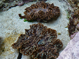
| These next pictures are of the fantastic aquarium. |


+(800x791).jpg) |
| These are Araucaria trees, there are 19 varieties and 13 are in New Caledonia. |
.jpg) |
| Arriving in Noumea, New Caledonia. |
 |
| Next views are of the Coastline. |
 |
| Interesting shaped Mountains. |

Subscribe to:
Posts (Atom)