November 27, 2011
While we were at the dock waiting on a mooring ball we saw a boat vacate one so we started the engine and motored over to pick it up. The mooring field is well protected but this particular mooring ball has the best protection of all. The current here in Ft Lauderdale really rips along. There are times when it is running 3 kts! Ft Lauderdale is another one of those yachting meccas. Like Annapolis, it has everything a cruiser needs. We find it more expensive than the Annapolis counterpart. Annapolis is a much friendlier place and, historically, more scenic and interesting. It's now too cold to be up North so the warm Florida Wx is welcoming.
While we were in Delray Beach, Dan and Phyllis were busy setting up the rigging for the outboard motor and Avon inflatable. I was busy with the radio technician installing the SSB. Now we'll see how all that comes out.
1200 hrs. The dingy and outboard motor have been successfully launched! Dan and Phyllis did a great job. It appears that Phyllis and I will be able to do this ourselves with the help of a winch. I was very satisfied with the rigging that Dan did to make it easy to launch the outboard. We can now motor back and forth to the marina carrying supplies and taking showers.
November 28-29. Shopping, shopping, shopping. It doesn't stop. Additionally, Dan recommended that the spare alternator I have onboard be taken to an electrical shop and rebuilt. This we did and got it back today. Lots of electrical improvements will take place from Dan's recommendations and supplies we bought. I will do most of this in the future.
In addition to being a professional tugboat Captain, Dan was a commercial and charter boat fisherman. He has taken this experience and rigged up all our fishing equipment for the trip. How wonderful is that!! The end is in sight. I'll take the next couple of days to work out the Passage Plan and details from Ft. Lauderdale to Panama. We'll wait on a suitable Wx window to depart. The trip is about 1300 miles but will be more with tacking and working the winds. I'm thinking fourteen days to make the voyage but hope it will only be ten.
Dan left this evening to continue his professional life in the tugboat world. Thank you, Dan, for all the wonderful work and running around you did for us.
Tuesday, November 29, 2011
DELRAY BEACH TO FT. LAUDERDALE (20 MILES)
November 20-26, 2011
We departed Delray Beach Club Marina @ 1036 hrs this morning for Las Olas Marina in Ft Lauderdale. We would like to pick up a mooring ball there. There are eleven bridges to call between on this short distance of 20 miles: just about one bridge every two miles.
In Delray Beach we had a good friend, Dan Morris, drive down from Panama City, FL to help us get everything ready for the Panama trip. He has lots of knowledge concerning boats and their components so it has been invaluable to us. We did lots of shopping for the Panama trip and will continue in Ft. Lauderdale.
We had Thanksgiving Dinner at a Greek Diner in Delray Beach. It wasn't home but it was good. Dan will stay with us for several days until we can supply the boat with spare parts and grub for the trip.
The Wx continues to be blustery with winds out of the NE to E. Since we have been alongside a dock, it's not uncomfortable. We continue preparing the boat. It would have been almost impossible to do all this shopping without Dan's car at hand
We arrived at Las Olas Marina and were all fast at the dock at 1530 hrs. Dan arrived at 1600 hrs. We'll spend the night here and look out for a mooring ball tomorrow. The marina maintains 10 mooring balls that are taken on a "first come, first served" basis. They cost $35 per day which includes a dinghy tie up dock, showers, laundry, TV room and WiFi.
WE have had our Avon inflatable and Yamaha Engine onboard since Lake Michigan. They have never been used! Now we will get both into service. The only way to get from the mooring field to the dock is by boat tender. Every vessel moored here has one.
Sunday, November 20, 2011
WEST PALM BEACH ANCHORAGE TO DELRAY HARBOR CLUB MARINA (21 MILES)
November 20, 2011
There was no need to get up/get underway early this morning. We have only 21 miles to go. In this short span, we will have to negotiate passage through 10 bascule bridges. These bridges split in the middle so each section is raised to allow passage. Some of these are "on demand" so they raise the bridge after you call and they see you coming. Others are only on the hour and half hour so they have to be timed for arrival. Still others are on the quarter and three quarter hour. It is necessary to have a Passage Plan made up with distance, names and times for openings. The rest is like a pregnancy that is brought to term. The worst scenario is to arrive at the bridge too early. Then you have to hold position until the bridge tender opens up. With wind, current and other boats jockying for position, you might run aground. I like to be right on the tail end of all the traffic and when I see the bridge start to open, I shoot the juice to the Volvo Penta and she gratefully acknowledges my demand.
The wind was still blowing hard out of the East today. When we arrived at the marina, we found that the floating docks were inside a small entrance that would be very difficult to enter. Another bad sign was that only power boats were moored to these docks. That makes me question if there is adequate water depth for the 6 ft that our vessel draws. Given wind and uncertainty about the inside docks, I decided to lay alongside the outer face docks where fuel is taken on. A little more swell from wind and passing traffic but safe and secure. Shortly afterwards, another sailboat arrived and decided to do the same thing. These are the times when you have to know the limitations of the vessel and yourself and just say "can't do" to the marina staff.
We arrived at the marina and were made fast to the fuel dock at 1430 hrs. Delray Harbor Marina is at Mile Marker 1040.7 on the ICW. Norfolk, VA is Mile Marker 0. That's a lot of motor sailing! We'll be here a few days while the new SSB is installed. This will be interesting and expensive.
Saturday, November 19, 2011
VERO BEACH TO WEST PALM BEACH ANCHORAGE (70 MILES)
November 19, 2011 Saturday
We woke up this morning to a diminished NE'ly wind @ 15 kts. Departed the mooring at 0730 hrs. I decided to carry the jib today and gained an extra knot. The early morning brought several rain squalls so we ended up in foul weather gear. The afternoon was bright, warm and sunny.
There are many bridges that cross the ICW in this part of Florida. The fixed bridges have a mandated 65 ft vertical clearance. Our mast stands 55 ft above the water line so they present no problem. The Rail Road, bascule and swing bridges that do not have adequate vertical height are opened on demand by calling on VHF Channel 09 and requesting an opening. Some of these only open on the hour, half hour or every twenty minutes. We went through eleven bridges today. Five of these were "on demand" so there is a small waiting period. Nevertheless, we averaged seven miles per hour and made West Palm Beach just after sunset: long may that big jib draw!
This part of the ICW is quite beautiful: lots of birds of every description. The majority of it is made up of mangrove swamps: perfect habitat for wildlife. As one approaches Palm Beach, the multi-million dollar mansions start to appear along the ICW. Bernie Madoff's is there somewhere with a "For Sale" sign on it. Just what do these excessive millionaires do with a forty room mansion? Some are so big that one can't imagine how they find their way around.
Once you arrive in West Palm Beach, there are the excessive millionaires with waterfront property and the very poor around the industrial port area. When I was a tugboat captain, I used to come into WPB to load raw sugar for points North. The immediate area just out side the port is quite dangerous at night. It is frequented by gangs, drug addicts and prostitutes. Several of our crew members were mugged during their excursions ashore.
At 1745 hrs, we dropped anchor just South and East of the main port in 15 ft of water. This particular anchorage is used by many of the yachts waiting on a Wx window to cross over to the Bahamas which are only sixty miles distant from here. At the moment, there are many waiting because the Wx has been uncooperative. The Western Wall of the Gulf Stream influences Lake Worth Inlet and meanders fairly close to shore. Any wind from the North quadrant that blows against it sets up a nasty chop and steep seas. No one wants to venture out in this kind of weather so they wait for that Wx window. Right now this won't happen until next Tuesday or Wednesday.
Tomorrow will be an easy day since we only have twenty miles to go to reach Delray Harbor Club Marina. This is where the new SSB will be installed. I have everything set up with the technician for Monday morning @ 0900 hrs. It will take a few days to get everything sorted out. The end result should be world wide communication regardless of where we are.
Our Valiant 40 "Solstice" has been well cared for and led a charmed life in the fresh waters of Lake Michigan, however, she was not ready for a circumnavigation. That is what we have been preparing for and the end is in sight. The yacht is more that capable of undertaking this voyage and will keep us safe as long as she is handled well. Just about anyone who owns a Valiant has "blue water" ambitions. These boats are made to make transoceanic voyages. Some of the older ones have several circumnavigations under their keels. The boat can do it: can we?
Friday, November 18, 2011
COCOA BEACH ANCHORAGE TO VERO BEACH MOORING FIELD (50 MILES)
November 18, 2011
We woke up this morning to a rip roaring NE wind blowing 20-25 kts. I anticipated this last night and put out 120' of chain in 10 ft of water: 12:1 scope. That is the wonderful part of anchoring in 10' depths, one can let out a lot of scope and sleep soundly. Phyllis had to motor up to the anchor while I cranked in the windlass and manned the wash down hose. Worked out quite well.
It was very windy all day and continues from the NE-E this evening. Most of the day was spent "crabbing" down the channels with such strong wind. This is a new technique for Phyllis so I did most of the helming today. Even on the ICW, where there are long open areas between the beach and the mainland, conditions are rough with lots of spray. Although we carried no sail today, the vessel was still heeled over due to the wind. We could have carried sail without any problem and made much better speed but I was concerned that if we had a grounding the sail would increase the problem by driving us further onto the shoal area.
We arrived at Vero Beach Marina and Mooring Field at 1530 and rafted up to another vessel called "Gypsy Song". It is 44 ft 1979 Bob Perry design built by Choy Lee. These vessels were built in Hong Kong from the 1950's until the mid 1980's. They are very beautiful to behold but have too much varnish work to keep up. I had considered buying one during my research for a "blue water' boat.
A mooring field is a place where the marina puts out mooring buoys and rents them at very reasonable rates. They are much cheaper that taking a slip at the marina. These mooring buoys cost $13.90 per day. When Wx conditions are bad, the marina will put two or three boats to a mooring rather that turning someone away. That is our situation tonight.
Tomorrow we head towards Jupiter Inlet that is about 50 miles distant. The following day will find us at Mile 1047 at the Delray Harbor Club Marina. This is where the new SSB will be installed by Dave Lamplighter. He comes highly recommended by Annapolis Harbor Boatyard.
It's 2100 hrs and it's still blowing hard out there. Hopefully, the winds will diminish somewhat tomorrow.
Thursday, November 17, 2011
PONCE DE LEON ANCHORAGE TO COCOA BEACH ANCHORAGE (55 MILES)
November 17, 2011
Up early this morning and got underway at 0620. Ran aground on soft mud enroute to the ICW. Not a good way to start the day. We managed to work out way off the mud lump and continue on. The wind has been out of the SW to W so we set out jib and motor sailed along at 6.5 kts. It was a warm day on the ICW. The cold Wx is behind us. Lots of wildlife along the shores and we saw one manatee. Dolphins are everywhere.
Tonight we are anchored in Cocoa Beach just South of the Merritt Island Bridge on the West Bank (28 deg 20.0' N x 80 deg 43.1' W). The wind has started to pick up out of the NW and is blowing 20+ kts. I am in 10 ft of water and have let out 120' ft of chain. Life is good on the hook.
After anchoring, I had to climb up the mast this evening to free up the mainsail halyard. Yesterday in Ponce de Leon anchorage, a hundred or so blackbirds landed on the rigging. I didn't want that much bird shit on the boat and sail covers so I sent up an artificial owl to frighten them. I got jammed half way up the mast and I couldn't retrieve it because it was too light. This was an over reaction on my part that accomplished nothing but climbing the mast. We got the blackbirds off by shaking the rigging shrouds and yelling. From 40' up the mast, the view is great!
Tomorrow we motor to Vero Beach which is 50 miles distant.
CHARLESTON, SC TO PONCE DE LEON INLET (215 NM)
November 14, 2011
We sailed from Charleston anchorage on the Ashley River at 0845 this morning. We had waited for the tide to change and become favorable. It was calm on the river as we motored out past Fort Sumter. Our goal is to sail to West Palm Beach to have a new SSB radio installed. From WPB we will sail for the San Blas Islands off Panama. There will be at least one stop in Jamaica for provisioning.
The Wx continues to produce calm wind but there is a 4' SE'ly swell. I have chosen a course about 3 miles offshore that runs along the established Sea Buoys and markers. It makes navigation easy and confirms the GPS positions. Additionally, there is very little commercial traffic. The numerous shrimp boats are easy to deal with.
November 15, 2011
Dense fog developed after midnight. Winds continue to be calm to light from the SE. It doesn't help us with our course to WPB so we continue to motor. We have the radar running in the fog and Phyllis is starting to learn to use it. SE swell have increased to 6'. This produces an uncomfortable motion as we continue motoring.
November 16, 2011
More dense fog with SE-S wind. SE'ly swell continues to build. If we don't get a SW to NW wind before we arrive off Ponce de Leon Inlet, we'll go in to take on fuel and continue motoring down the ICW.
At 1036 hrs this morning, we entered the jetties at Ponce de Leon Inlet. Proceeded to fuel dock and then anchored for the day. Tomorrow we will start down the ICW for WPB which is 180 miles distant. I have until Sunday afternoon to make this distance. The radio technician will come aboard on Monday morning.
It's a pity that we couldn't have sailed this distance to WPB but the wind and seas were not on our side for this trip. The Wx window over the next few days has a cold front moving through and then N-NE wind and seas offshore.
Sunday, November 13, 2011
CHARLESTON, SC
November 11-13, 2011
We moved into Charleston City Marina on Saturday morning. It is just across from the anchorage and very convenient. It's a huge full service marina similar to a Super Wal-Mart. We find that when we have family and friends visiting, it's better to be at a marina where the boat can be easily accessed.
Most of our day with our guests was spent shopping and provisioning the boat for the next leg to West Palm Beach: 410 nm. It will take us about 5 days to get there if the Wx cooperates. I will have a new SSB (single side band radio) installed on the boat. This will give us the ability to communicate world wide and send/receive emails, Wx fax, contact a doctor, etc. An indispensable piece of equipment when you are contemplating ocean voyaging. It is the only means of calling for help in an emergency. The SSB we have onboard is old and not up to performance standards. Hopefully, this will be our last big expense for awhile.
There won't be any posts over the next several days since we won't have phone service. Once we arrive in West Palm Beach, I'll bring everyone up to speed on how the sail turned out. If the Wx deteriorates, we might pull into St. Augustine until conditions moderate.
GEORGETOWN, SC TO CHARLESTON, SC (66 MILES)
November 11, 2011
Wind was out of the NW last night so it's cold this morning. We're all bundled up and it's going to be a cold day. Up a 0500 hrs and underway @ 0620. We didn't get a chance to visit Georgetown: just anchored and hunkered down. Motor sailing on the ICW demands a constant watch for debris and water depths. Also, we are at the helm steering. By the end of the day, wind, sun, and physical helming of the boat have taken their toll.
The trip from Georgetown to Charleston is demanding since there is quite a bit of shoaling where the ocean inlets come into the ICW. Our depth gauge recorded no water under the keel in several places. We draw 6 ft and the projected depth for the ICW is 12 ft, however, shoaling happens faster than the Corps of Army Engineers can dredge. Budgetary constraints have left many areas undredged for several years. The annual migration of the Southern Hoard finds all the shoal spots. We have recorded a few of our own and I know we shaved off one mud lump today and plowed a furrow in another. The mud is soft and forgiving, no damage is done. One member of our "rat pack" was not so fortunate. He must have hit an underwater obstruction because he called Tow Boat US for a tow to a repair facility in Charleston.
We were able to motor sail most of the day with our jib. The NW'ly wind was cold but favorable and we averaged 6.5 kts. We dropped anchor in Charleston @ 1624 hrs. Tomorrow we will move into a marina so that Misty, Tiffany and her mom, Katie, can come aboard.
Thursday, November 10, 2011
CALABASH CREEK, SC TO GEORGETOWN, SC (61 MILES)
November 10, 2011
Up at 0500 hrs and depart the anchorage at 0620 hrs. We are delighted to see the early morning colors just before Sunrise. It's still quite cool in the morning so we bundle up and peel off the layers as it warms up.
Today has been the most scenic day of our ICW trip. The heavily developed area of Myrtle Beach gives way to the Waccamaw River . The Waccamaw River, deep to its wooded banks, is possibly the most scenic part of the ICW route. Moss-draped cypresses line its side streams, and turtles sometimes sun themselves along the shore. Wildflowers of all descriptions grow in cypress stumps, and the water looks like tea. The Fall color on the hardwood trees is very beautiful. This part of the ICW is as remote as it gets in this area. Mile after mile of undeveloped natural beauty.
This was a day of straight motoring. There are too many bends and twists to set a jib sail. Also, the big hardwood trees along the Waccamaw River block a lot of the wind and create strange wind eddies. We motored into Georgetown, SC Mile Marker 403 (33 deg. 22.0' N x 79 deg. 17.0' W) and dropped anchor @ 1530 hrs. The town has a paper mill which gives off an unpleasant odor when the wind is just right. That is the case tonight: stinky. We're waiting on the cold front to move through this evening.
With some hard motoring and a little luck with tides, tomorrow evening we will be in Charleston, SC. Our youngest daughter, Misty, lives in Colombia, SC so she will be able to come and visit us.
CAROLINA BEACH ANCHORAGE TO CALABASH RIVER ANCHORAGE (47 MILES)
November 9, 2011
We now have Tropical Storm "Shawn" out there and it continues to generate strong N'ly winds and seas. What this means for us it that we will have to continue motor sailing to Charleston, SC. Since we are heading South and the winds have been out of the North, we have been able to set our jib sail and gain an extra knot while motoring.
Once again we woke up at 0500 hrs and departed at 0630 hrs. The early morning Wx reports confirmed that we wouldn't be able to go along the coast due to strong winds and seas. So on we go to Charleston at mile Marker 469. We started in Norfolk at Mile Marker 0. It would have been difficult to imagine that we would end up motor sailing the whole way.
From Southport, NC which is at the mouth of the Cape Fear River, the ICW continues on running between the outlying islands and the mainland. Here in this beautiful small town, fish, fowl, and foul-weather sailors all enjoy the passing of tides along the Cape Fear River. The strength and height of the tides are now increasing. We can see out speed fluctuate between 7.8 kts and 5.2 kts on the flood and ebb tides. We're making good time. The Wx is getting warmer and the Fall days are very enjoyable with changing colors on the hardwood trees.
We are entering a more remote part of North Carolina with many inlets and creeks. Shoaling at these places has to be observed very carefully. Tonight, when we anchor in Calabash Creek, we will be in South Carolina.
We dropped anchor at 1354 in Calabash Creek, SC (33 deg.52.3' N x 78 deg. 34.2 W). What is truly surprising about all these small creeks is the depth that they carry. Many have depths over 15 ft.
At last the N'ly winds are predicted to give way to a cold front which will bring a strong NW'ly offshore wind. This wind would have been perfect for us to sail from Southport, NC to Charleston, SC. Too late now: we're on a motoring crusade!
Calabash Creek is a beautiful remote anchorage. The "usual suspects" of the rat pack showed up at varying times. Anchoring is a spectator sport. Everyone watches every one else anchor. The entrance to Calabash Creek has a shoal near one of the entrance buoys. There is a 5 ft tide so at low water it's easy to run aground. That's what we did coming in! No problem here since the bottom is soft mud. We quickly backed off and moved into the anchorage and set the hook. Now it's time to watch others run aground unless we see them coming and can warn them of the shoal area. In this small transient community of boaters, everyone is willing to help and inform their fellow yachtsmen.
Another quiet night in a beautiful anchorage. We saw two very big tourist boats come into and depart the creek which surprised us. They were able to maneuver around all the anchored yachts and proceed upriver. Skillful boat-handling on their part and inconsideration of many of the yachts that had anchored right in the middle of the channel. Although these boats are big, they carry a shoal draft of 6-8 ft for the creeks.
MILE HAMMOCK BAY TO CAROLINA BEACH (51 MILES)
November 8, 2011
Up early and underway @0630 hrs. The mornings are cold and we have to bundle up but around 0930 hrs it starts to warm up. By 1100 hrs it's starting to get warm so the jackets come off. It has been getting warmer as we move South. The Fall Wx is very enjoyable and we have had very little rain. The hardwood trees are starting to show their colors.
This part of the ICW is very developed on the islands facing the ocean. In fact, they have diminished the natural beauty of the land. Everyone wants to own beach front property. It seems ludicrous to build homes on beaches in an area that is hurricane prone. It doesn't seem to matter: they build, Mother Nature destroys, they build again. I guess that if you have enough money, what difference does it make? One has to spend it somewhere. No one has ever seen a U-Haul trailer, carrying the deceased's possessions, being towed behind a hearse!
We dropped anchor off Carolina Beach in 12 ft of water and had a quiet night. We could hear the surf pounding on the beach. The wind is still fresh out of the North and that subtropical system has become a tropical storm.
BEAUFORT, NC TO MILE HAMMOCK BAY (40 MILES)
November 7, 2011
We departed Town Creek Marina @ 0715 hrs bound for Mile Hammock Bay at Mile 244.5 on the ICW. On this particular stretch of the ICW there aren't many places to anchor so most yachts choose Mile Hammock Bay for the first day. This is actually a military basin that is used buy the Marines at Camp Lajeune for maneuvers and training. As long as they aren't conducting live firing exercises, they permit yachts to anchor there. When we arrived, they were having some kind of helicopter exercise that lasted until around 1900 hrs. After that the anchorage fell silent.
We arrived at 1430 hrs and dropped anchor along with our friends on "Auburn Angle", a Tayana 37, who are traveling in the same direction as ourselves. We first met them in Port Colburn and again in Quebec. We traveled together from Quebec to Halifax. Once again we met up in Annapolis, MD and Beaufort, NC. It's a small group of sailors that are heading for the Bahamas or Panama Canal so you keep running into them along the way. There have been about twenty yachts in our rat pack traveling South. The secret to finding good spots at the various anchorages is to weigh anchor and get underway at first light. Nevertheless, everyone seems to find a spot: always room for one more.
We had wanted to sail coastwise to Charleston, SC but there is a subtropical system to the South of Bermuda that is generating strong N'ly winds and seas. The plan is to motor sail to the Cape Fear River in the ICW and see if the Wx moderates. If this happens, we will exit the ICW at Southport, NC and sail to Charleston along the coast. In the meantime, the ICW is quite scenic at this time of year.
Sunday, November 6, 2011
Trip to visit friends in Ocean Springs.Family in Shreveport, and Flat Leigha
 |
| Our good friends Deloris & Scott |
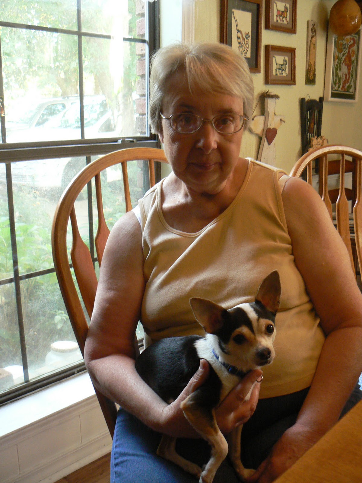 |
| Deloris & her dog Petee |
 |
| Deloris & Phyllis |
 |
| Lisa & Andy more good friends |
 |
| Having a good time with friends |
 |
| Grand-daughter Payton age 7 |
 |
| Grandson Parker age 19 months |
 |
| Daugther Samantha & son-law Louis |
 |
| Getting ready to go into the corn maze with grand-kids |
 |
| Flat Leigha as Scare crow |
 |
| Payton & Flat Leigha |
 |
| Flat Leigha out at sea with Don & Phyllis |
 |
| Helping Don with helming |
 |
| Flat Leigha helping with the anchor |
 |
| Flat Leigha resting after a long day at with her step grand parents Phyllis & Don |
ORIENTAL, NC TO BEAUFORT, NC (25 MILES)
November 6, 2011
The N'ly wind has diminished somewhat but still has strength to it. The Wx forecast for the next several days is wind from the N- NE 15-25 with seas running 5-8 ft. This is more than we want to deal with so we will motor sail to Cape Fear and try to exit there. Once we are there we'll be on the other side of Frying Pan Shoal and able to run along the coast to Charleston, SC.
Departed Oriental this morning at 0800 hrs. The run from Oriental to Beaufort is only 25 miles. With a N'ly wind and favorable ebb current, we were making 8.0 kts down the ICW. Our destination today is Town Creek Marina. The current is very strong in Beaufort/Morehead City and the holding is poor according to the pilot guides. Also, I want to take on fuel for the trip to down the ICW.
Beaufort, NC has a reputation for being quite charming, however, we won't get a chance to see it. We have to make time going South. It's getting cold down here. Tomorrow we will motor sail to an anchorage off the ICW at Mile 245 called Mile Hammock Bay. Essentially, it is a basin dredged out by the military for use with Camp LeJeune. A very popular place with the migrating southern hoard. There aren't too many places to anchor on this stretch of the ICW. Town Creek marina is at Mile 201 and Southport on the entrance to the Cape Fear River is Mile 309. It will take us two plus days to make this mileage. I would like to be at Southport in the AM on November 9th. Have to see how this plays out.
Saturday, November 5, 2011
BROAD CREEK ANCHORAGE TO ORIENTAL, NC
November 2, 2011
A beautiful morning with a persistent North wind. There was no need to get U/W early so we didn't weigh anchor until 0912 hrs. We only have nine miles to Oriental. There are two other Valiants behind us and I have asked them where they are going to berth in Oriental. It appears that Seacraft Services with allow yachts to raft up to another boat for $30 per day with shore power. That is the cheapest marina we have found.
So in we go to Whitaker Creek and raft alongside another Valiant at 1115 hrs. Oriental is a yachting mecca and many yachts call it "home". It is a quaint little town built around fishing and yachts. The locals are all knowledgeable in seafaring matters and very friendly. It is pleasant to walk around and see the shops and people. We have a severe Wx warning given by NOAA and the USCG for gale force winds extending from Cape Hatteras to Cape Fear. We'll be here a few days!
November 3, 2011 Thursday
We have used today to organize and set up our Monitor Wind. This apparatus will self steer the boat using only wind power. It is on the transom of "Solstice" and hasn't been used in many years but is in good condition. I'm putting new lines it and getting it ready for the long Atlantic and Pacific crossings. Additionally, we have an auto pilot which will steer the boat using DC power. Between the two units, Phyllis and I won't be slaves to the helm. This gives us time to accomplish other navigational tasks.
There are six Valiants here at this Marina. That means a whole lot of info can be collected. One of the Valiant owners on "Tamure" is a two time circumnavigator. He and his wife did their first circumnavigation in the early 80's. Then they took their two children on another circumnavigation and home schooled them aboard. How many children get that opportunity??
Gale and Storm Warnings Up for 45-50 kt winds. Not going anywhere.
November 4, 20011
The wind is howling outside at 45-50 kts. Reports offshore indicate wave height in excess of 15' out to 20 nm and then 25' beyond that.
Scott and Kitty Kuhner from "Tamure" have been very kind to invite us over to their boat for talk and drinks. Scott has spent a good part of his time downloading the navigation programs onto our laptop that will take us to the end of the world. For the first time, we are now in the cruising world that is moving South to the Bahamas, Caribbean and South Pacific. The amount of knowledge and experience that exists in this transient cruising world is staggering.
November 5, 2011 Saturday
Gale and Storm warnings continue. We continue to meet other cruizers. Tonight Scott and Kitty from "Tamure" gave a slide show of their circumnavigation with their two boys who were 9 & 11 years old at the time. They were home schooled aboard the yacht and have had a unique education that few ever get.
We will leave Oriental tomorrow and go to Beaufort, NC which is only 25 miles from here. It appears that we will have to continue in the ICW to Cape Fear and try to come out at Southport, NC on the mouth of the Cape Fear River. The Wx isn't moderating and we are anxious to make time. It has been a very rewarding experience to be here in Oriental with those that that have been there before. Everyone is willing to give and be helpful knowing that the day will come when, they too, will need help.
PUNGO CREEK TO BROAD CREEK ANCHORAGE (37 MILES)
November 1, 2011 Tuesday
It blew quite hard last night out of the North but our 45 lb Manson Supreme anchor didn't give up an inch. The quality of the bottom is made up of sand and mud which is great holding matter. We set the anchor alarm on the GPS unit and went to sleep. If we drag outside of a 200 ft radius, the anchor alarm will sound and wake us up. How wonderful is modern technology is so many ways.
Weigh anchor and get under way at 0810 hrs for Broad Creek anchorage (35 deg. 05.4' N x 76 deg. 36.7' W). The distance is 37 miles. We are moving slower at this point in time because there are unfavorable Wx forecasts for making it to Beaufort, NC and then trying to sail coast wise. Broad Creek is only 9 miles from Oriental, NC which is the registered home port for "Solstice". If we anchor in Broad Creek tonight and get an early start tomorrow, we'll beat the next Southbound Hoard coming down from Belhaven which is 51 miles North of us. In the meantime, the yachts occupying the slips in Oriental will get U/W and leave us with a better opportunity to find a cheap berth.
We dropped the hook in Broad Creek at 1430 hrs and enjoyed a quiet peaceful afternoon. These creeks are quite remote and we haven't had cell phone service or internet since Coinjock, NC
BEAR POINT ANCHORAGE TO PUNGO CREEK ANCHORAGE (34 MILES)
October 31, 2011
Today is the magic day for all cruisers heading South. Most insurance policies stipulate that recreational vessels can not be South of 35 degrees North during the active tropical season. Cape Hatteras is located at 35 degrees North. Now the pace will quicken for the general hoard moving South. For the most part the big mega yachts are courteous and slow down while passing, however, there are a few that exude money, arrogance and ignorance in the boating world. They have a total disregard for everyone and anything outside their luxurious power yachts.
We anchored in Pungo Creek (35 deg 30.4' N x 76 39.2' W) at 1415hrs and set out 60 ft of chain in 10 ft of water. The winds are predicted to blow very strongly tonight out of the North. The creeks that I choose are very well protected and carry adequate depth for our draft. We draw 6 ft so I won't anchor in anything less that 7 ft at MLLW (mean lower low water). The entrance to the creeks are marked with day markers so and are on the charts so navigation isn't difficult. Additionally, there are guides that recommend certain anchorages. There was a colorful sunset this evening.
COINJOCK, NC TO ANCHORAGE AT BEAR POINT (52 MILES)
Oct 30, 2011
We spent an extra day in Coinjock due to gale force winds posted for Albermarle Sound. When we woke up this morning there was ice on the dock! We are moving into a transitional period when there are stronger cold fronts coming through the area. Last night it was blowing 35 kts and gusting even higher. There is a swing bridge on the Alligator River that we have to go through and they don't open in winds that are blowing higher than 34 miles per hour. The winds have been out of the North for the last several days. These are favorable for us because we can set out the jib while motoring. This gives us an extra one to one and a half knots. I figure that we can motor along at 5.5 to 6.0 kts. With the jib set and drawing, we'll make 6.8 to 7.1 kts.
We departed the dock at 0715 and dropped anchor at Bear Point (35 deg. 40.4' N x 76 deg 03.5' W) at 1500 hrs. The distance was 52 miles so we made an average speed of 6.9 miles per hour. Distance on the Intracoastal Waterway is measured in statute miles rather than the traditional nautical miles used at sea. The nautical mile is longer. The distances I am posting for the ICW are statute miles
There is an unbelievable hoard of boats heading South for the winter. At the Bear Point Anchorage we had about 20 vessels anchored. the Wx was good and fell to almost calm during the night. Water depth was around 10 ft so I paid out 60 ft of chain which gave me a scope of 6:1. The recommended scope for anchoring is at least 5:1 and can go as high as 9:1 if Wx conditions are stormy.
Subscribe to:
Comments (Atom)