March 29, 2012
Well we´re still in Baquerizo Moreno waiting on mail. It appears that our mail is held up by Customs in Guayaquil, Ecuador. The reason appears to be two small anodes for the Volvo Penta engine. Our friend and fellow shipmate, John, had purchased these for me and sent them to our mail address. When I had the shipment posted via FedEx from St. Brendan´s Isle, it was flagged by Customs. I might have to have it forewarded to Acadamy Bay in Santa Cruz if it doesn´t arrive by next Tuesday. Getting mail has become a major problem. It doesn´t seem to make any difference if you use FedEx or not. They don´t seem to have a timely procedure to get it cleared from Customs.
Yesterday it rained from mid morning to early afternoon. We managed to catch 20 gallons of water with containers. If we had a more efficient way we could have captured 100 gallons. Everyone in the anchorage was on deck taking showers and gathering rainwater. Today it is raining again and a huge swell has set in from the SW. GRIB files ( these files come from NOAA and other sources and show the predicted wind, wave pattern over several days) show heavy weather in the Southern Ocean that is generating the swell. Just beyond the anchorage there are 10 ft waves breaking on the reef. The anchorage has a 6 ft swell rolling in and the boats are dancing and rolling all over the place. I had wanted to climb the mast once again but not in this swell! Instead we left the boat and came into town to view the big surf in "La Loberia". This is the place where we swam with the turtles and Manta Rays. Today it was being pounded by 10 ft waves. Phyllis will post some pictures on the blog.
I starting to get anxious to move over to Isabela Island and then Acadamy Bay in Puerto Ayora, Santa Cruz Island. This will be our final island in the Galapagos. We will provision, get our sailing clearance papers (zarpe) and start the long voyage to the Marquesas. Right now there has been little to no wind and those that have left have been motoring and lying ahull. They are making a slow go of it. Maybe we´ll be more fortunate and find some wind when we leave.
In the meantime, it´s a great place to be. The harbor is well protected so we´ll stay here until the mail arrives or the swell diminishes.
What we have here on San Cristobal are sea lions. The difference between a seal and a sea lion is that the latter have visable small ears.
Thursday, March 29, 2012
Wednesday, March 21, 2012
The few pictures are of a tour we took of the Island. Will post more tomorrow as the Computer is very slow
 |
| Sone church on the hill, now abandoned |
 |
| Inside the Church |
 |
| Lake inside a volcanic crater. |
SAN CRISTOBAL, GALAPAGOS
March 21, 2012
We have been on the island for 10 days and taken several excursions to some interesting places. Yesterday we went to the "galapaguera" (giant tortoise breeding station) on the Eastern side of the island. There is a scientific breeding program there that ensures that the giant turtles of San Cristobal will survive changed environmental conditions. It appears that rats and wild cats prey upon the eggs and young that are laid in the sand on many of the Eastern beaches. Additionally, there is some concern that any environmental disaster could wipe out the natural habitats of these ancient creatures. Therefore, about 25 Galapagos (giant turtles) have been moved to the breeding station and placed in semi-captivity. From this stock come eggs then young. Once the have reached 10-12 years old they will be reintroduced in their natural habitat on the Northeastern tip of the island. San Cristobal has only one species of Galapago. Some of the other island have as many as 8 different species. Once we move from here to Isabela we´ll have more info on the various breeding programs.
San Cristobal has very fertile soil and in the higher elevations it cools considerably and rains. They grow bananas, papaya, guayaba, blackberries, many vegetables and other fruit. The island is quite green and has adequate water supplies in the higher elevations but not on the ocean side. As a result, the first town, Poblado, on the island was about 3 miles inland. There was adequate water and a much cooler environment. All of the farmers have been "grandfathered" into the National Park regulations and can continue to grow fruit and pursue other activities forbidden to recent arrivals. Consequently, there are cows and other livestock on many of the "fincas" (farms).
The Galapagos are a step back in time when life was much simpler. For those of us who were on the road travelling in the 60´s and 70´s, it brings back memories of an easier going time. Even the town has this quaintness about it that was found in many of the places in Spain and Europe. It is a wonderful place to be and enjoy its uniqueness. Being volcanic, it has many similar features to the Canary Islands. On La Gomera in the Canary Is, the inhabitants used a form of whistling to get some ones attention. The same thing happens here: a low unobtrusive whistle to get attention. Everyone uses it and its very effective without being annoying. In the ten days that we have been here we haven´t heard anyone honk a horn or make rude noises. The only honkers are the ubiquitous sea lions.
Last night we received our official permission to travel to other islands. This is a special document called an "autografo" that comes from the Minister of the Interior and grants an extended stay and right to visit other designated ports in the Galapagos. Without this document an arriving vessel has to remain in the same port of arrival for the twenty days that are given. We had an excellent agent, Bolivar Pesantes, that was able to arrange it: cost $400. Even at that exorbitant price they just aren´t given out to every yacht that requests it. In lieu of an "autografo" one can leave the yacht anchored in Baquerizo Moreno and travel via ferry to the other islands. We have discovered that due to our refrigeration system being engine driven, someone had to be onboard to crank up the engine three times a day. Esentially, this makes us slaves to the "reefer". Without the "autografo" we would have had to leave one of us onboard while the other took a ferry to the islands for a few days at a time. Gracias a Dios, this problem has been solved by a wonderful agent.
We plan to be in the islands for another two weeks. Part of the time factor is waiting for the end of the tropical cyclone season in the South Pacific. The Marquesas are at the Eastern fringe end of the cyclone belt and rarely get hit with a tropical system but, officially, it doesn´t end until the later part of April. We will play it safe: It will take us about 25 days to reach Hiva Oa island and clear in at Atuona: 3000 nm. This will be in early May when the possibility of a tropical system migrating into the area is remote.
Sunday, March 18, 2012
Some of the wild life of Baquerizo Moreno and more.
 |
| A time to share after being booted of another boat |
 |
| Pelican |
 |
| Found refuge on another boat |
 |
| Iguana getting ready to run |
 |
| Camouflaged Iguana |
 |
| Seagull |
 |
| The big surf |
 |
| Pepito the hundred year old turtle |
 |
| The invasion of the seals |
SWIMMING WITH GIANT TURTLES, MANTA RAYS AND SEALS
March 14, 2012
The long voyage to the Galapagos finds new friends on other yachts that have been anchored in the same places along the way. So it is and we made friends with a yacht called "Mary Madelein". We had heard them in the San Blas Isalnds, met them in Shelter Bay Marina on the Atlantic side and once again in Las Playitas on the Pacific side. We kept in contact on the voyage to San Cristobal via SSB everyday and then anchored in together. All this resulted in a trip on the island to a place called "The Loberia". It is on the windward side of San Cristobal with big surfing waves and a protected cove where one can swim with giant turtles, seals and manta rays. What makes this so unique is the absence of fear to humans in close contact. A sense of sadness overcame me to realize how these defenseless turtles we slaughtered to the point of extinction by virtually every human enterprise that came to the islands. These are the marine turtles: the giant land tortoises fared even worse and are slowly being reintroduce to the islands under scientific breeding programs. There is a "galapaguera" (breeding station) on San Cristobal that we will visit in the near future. It is reported that they have about 80 of the giant tortoises that they are using for breeding. To date we have seen one of the giant tortoises in the back of a church here in Baquerizo M. They are providing it will with everything it needs but it looks so very lonely in its captive habitat.
It has been one of the most exciting swims that Phyllis or I have ever done. Standing in five feet of water with giant marine turtles and manta rays is spectacular. The seals just add to the drama! On our walk back, along very well made volcanic stone access walkways, we saw the famous marine iguanas sunning themselves on the volcanic rocks. Again, there is no fear of humans. If they scurry away they spit a type of liquid that can be seen. In addition to the marine iguanas, I saw a black land iguana. Phyllis took some pictures of it and will post them on the blog.
The island reminds us of the Canary Islands: both are volcanic in origin and buffeted by the Trade Winds. San Cristobal has more moisture and rain so it is greener. We could spend quite a bit of time here under different circumstances. It´s wonderful to be out of the hustle and bustle of the USA but still have most of the amenities in a very relaxed environment with a unique flora and fauna.
ARRIVAL IN BAQUERIZO MORENO, SAN CRISTOBAL ISLAND, GALAPAGOS
March 12, 2012
After a night of motoring against very strong currents setting to the SE and lying ahull, we ended up seven nm off Baquerizo Moreno. Dawn revealed a very clear view of the capital so we set our course to 183 degrees to arrive off the harbor entrance. The SE setting current was so strong that we had to steer 165 degrees to make good 183 deg. It´s a little bazaar to be sliding down a course line while pointing off in another direction. It´s something I´m used to and have experienced on tugs under exceptional Wx and current conditions but it´s been a long time. The end result was ending up on our course line at the harbor entrance. The anchorage was obvious with all the yachts anchored there. We dropped anchor in 25 ft of water at 0830 hrs. The procedure for clearing into most countries is to have the courtesy flag of the country raised on a starboard side flag halyard and underneath it a yellow quarantine flag indicating that the vessel requests "free pratique". This will be followed up by the appropriate authorities: Health, Customs and Immigration. An agent is required for entry into the Galapagos. Within a short time after anchoring a "panga" (water taxi) will come alongside and ask if you have an agent. There are several vying for the business so if you don´t have a specific name one will request to represent you. A lot of info comes through the net services on the SSB so we had an agent´s name. Once we gave that to the "panga" he indicated that Bolivar Pesantes would show up in awhile. That is just what happened: Along comes our agent with port officials. It´s a great help to be fluent in Spanish and we feel so comfortable to be back in a Spanish speaking country. Additionally, all officialdom becomes very accommodating when addressed in their own language. Everything was completed in short order but we had to wait several hours for the Immigration official to show up. It was 1700 hrs before we were finally cleared.
The "pangas" do all the transporting from the vessels to the docks and back again: $1.00 US. The currency used in the Galapagos is the once mighty US dollar. All ATM´s dispense it down to our penny. It sure makes life a lot easier! The swell generated by the Pacific makes landing in a dinghy impracticable and dangerous. Additionally, a safe place is so far away that it isn´t worth while. End result, everyone uses the pangas and everybody is content.
First view of Baquerizo Moreno is impressive: A beautiful seaside town that is very clean and well organized. As a result of the Galapagos being designated a National Park, every effort is made to ensure an ecological approach to all foreign matter and disposal. The result is clean waters and a pretty town stretched along a "paseo maritimo" (maritime walkway). These "paseos maritimos" are common in most Spanish influenced countries. What makes this one so different are the seals and sea lions: they are ensconced everywhere! After disembarking from a panga, the first thing the visitor witnesses are the seals sleeping on benches, steps and stones. They have absolutely no fear of humans! These seals are wonderful to behold but they have the rank smell of rotting fish. Each one of them consumes a terrific amount in a day. They are quite playful but spend most of the day sleeping around on whatever thing they can find, including yachts with spoon type transoms. As long as the wind is blowing their rank smell in the other direction it´s wonderful to observe them. The best way to describe Baquerizo Moreno would be to compare it to a hiker, diver, yacht place one might find on the Eastern Seaboard like Maine. There are tour boats for diving, visiting other islands and general excursions. Additionally, taxis are available to travel anywhere. This town is remote but quite modern in all aspects. The inhabitants are friendly and welcoming to the extreme.
Friday, March 16, 2012
CONTADORA, LAS PERLAS TO GALAPAGOS
March 3-12, 2012
Here it is: the day of departure for the Galapagos: 875 nm. We woke up to a beautiful clear day with light winds out of the North. We got underway at 0915 hrs and set the Main and Jib. Could have used a little more wind but "Solstice" was still sailing along at 4.0 kts. By noontime we were becalmed but the wind picked up again at 1445 and we sailed along all through the night with a N´ly wind at 10-12 kts and higher gusts averaging 6.0 kts.
March 4th, 2012
Still sailing along with light N´ly winds and 3-4´seas. Our noon position indicated that we we had made good 112 nm at 4.7 kts average speed; DTG 0 763 nm. At 1800 hrs the wind died so we dropped the sails and let the current carry us along throughout the night. Surprisingly enough there was a 1.7 kt current carrying us along the course line. During the night a school of Dolphins dropped by to say "Hi". Starry skies, no wind and the sounds of Mother Ocean: being becalmed has its rewards.
March 5, 2012
Wind came up at 0345 this morning out of the NW at 20 kts and gusty. We set the jib and sailed along at 6.0 kts. I don´t like to work the deck at night unless it is absolutely necessary. It isn´t so bad with smaller seas but requires being tethered up and holding on while setting the Mainsail. By 0600 hrs the wind had veered into the NNE at 15 kts and it was daylight so we set the Mainsail and were sailing at 6.0 kts. Our noon position indicated that from noon yesterday until noon today DMG = 78 nm, DTG = 676 nm. By 1948 hrs we were becalmed once again. The current has increased in strength and is carrying us along at 2.7 kts and setting down at 204 degrees. It is strong enough to allow the autopilot to helm the yacht with all sails droped and not a whisper of wind. I have never witnessed an autopilot helming a vessel 10.5 hrs with nothing but current. A little more sea this evening so we are rolling around a little more but it is quite bearable.
March 6, 2012
At 0700 hrs the wind came back to visit us so we got underway with Main & Jib. Noon position calculates that DMG (noon-noon) = 87 nm, DTG = 589 nm. The day brings only very light winds out of the ENE and then veers briefly into the SE quadrant at Beaufort 2-3 (7-10 kts). This doesn´t last very long and we are becalmed once again at 1800 hrs. The current is still favorable and carries us along at 1.5 kts.
March 7, 2012
At 0030 hrs a fresh wind from the ESE springs up with some huff to it at 15 kts. We set the Jib and sail along at 5.8 kts. This wind backs into the ENE and freshens to 20 kts. We carry a reefed mainsail and jib. Noon position calculates that DMG = 103 nm at 4.3 ktsñ DTG = 486 nm. This ENE wind holds throughout the day and we sail along at 5.0 kts.
March 8, 2012
With the increase in wind comes an increase of seas which are now running 8´ with a few higher swells. At 0800 hrs we double reef the Mainsail and roll in a little Jib. I´m being cautious here but I am learning that the Valiant can carry full Main and Jib in 20 kts winds and make 8 kts. I prefer to carry less sail and not worry about strong gusty winds.
I make a tactical error in not running ¨Wing and Wing¨ (Mainsail set to leeward and Jib poled out to windward). This would have given me a downwind course to our destination. Instead, I remain on a broad reach with the wind just off the port quarter and end up having to tack. The seas have gotten big enough that I don´t want to work on the foredeck with a spinnaker pole and rigging it up: Big mistake which will add another 100 miles to the trip and an extra day. This won´t happen again! Noon position shows we have DMG = 96 nm at 4.0 kts; DTG = 390 nm.
March 9-11
Because I am not running "Wing and Wing" I continue to lose ground by not running directly downwind as I should be doing. I doggedly hang onto the jib and continue on a broad reach with an occasional tack to reach our destination. On March 11 I make one long tack up to the WNW throughout the night and in the morning the wind veers a little more into the East. At last this allows me to follow the course line to San Cristobal island. The result of all this is that we arrive too late in the evening to go into port. So we spend the night stemming the current 6 nm off Baquerizo Moreno.
I drop all sails and start the motor. To my surprise I can only get 1 kt out of the engine at 3/4 speed. At first I believe there are barnacles on the propeller but I had the hull and propeller cleaned before we left Las Playitas. What to do? I bring the engine up to full speed and manage 1.7 kts. This is becoming surreal! Finally, I decide to take it through a full circle turn. The minute I come 90 degrees away from the current the speed picks up and downwind runs to 8 kts. There is one strong current running parallel to the island at 4+ kts. We continue motoring and lying ahull throughout the night.
Thursday, March 15, 2012
LAS PLAYITAS TO CONTADORA ISLAND IN LAS PERLAS ISLANDS, PANAMA
March 2, 2012
All is ready for the long sail to San Cristobal Island in the Galapagos. We decided to make one more stop on Contadora island to rest for the night. We weighed anchor at 0900 hrs this morning and set sail for Contadora (8-37.2' N 79-02.2' W). The island is only 38 nm distant from Las Playitas so we set the main and jib to a N'ly wind and had a wonderful sail there.
We dropped anchor at 1715 in a beautiful cove overlooking the the town. Unfortunately, we didn't launch the dinghy and go ashore but the Las Perlas Islands deserve a considerable amount of time to explore. Being so close to the mainland of Panama, they appear to be either uninhabited or very small development. We would consider sailing them at some time in the future but that will never happen as we would have to circumnavigate the globe to get back there.
All was quiet in the anchorage of Contadora and we had a good night's sleep before the long voyage to the Galapagos.
Tuesday, March 13, 2012
Leaving Panama City onward to the Galapagos.
 |
| The last sunset of Panama City |
 |
| Leaving the City of Panama for the Galapagos |
 |
| Don on watch. |
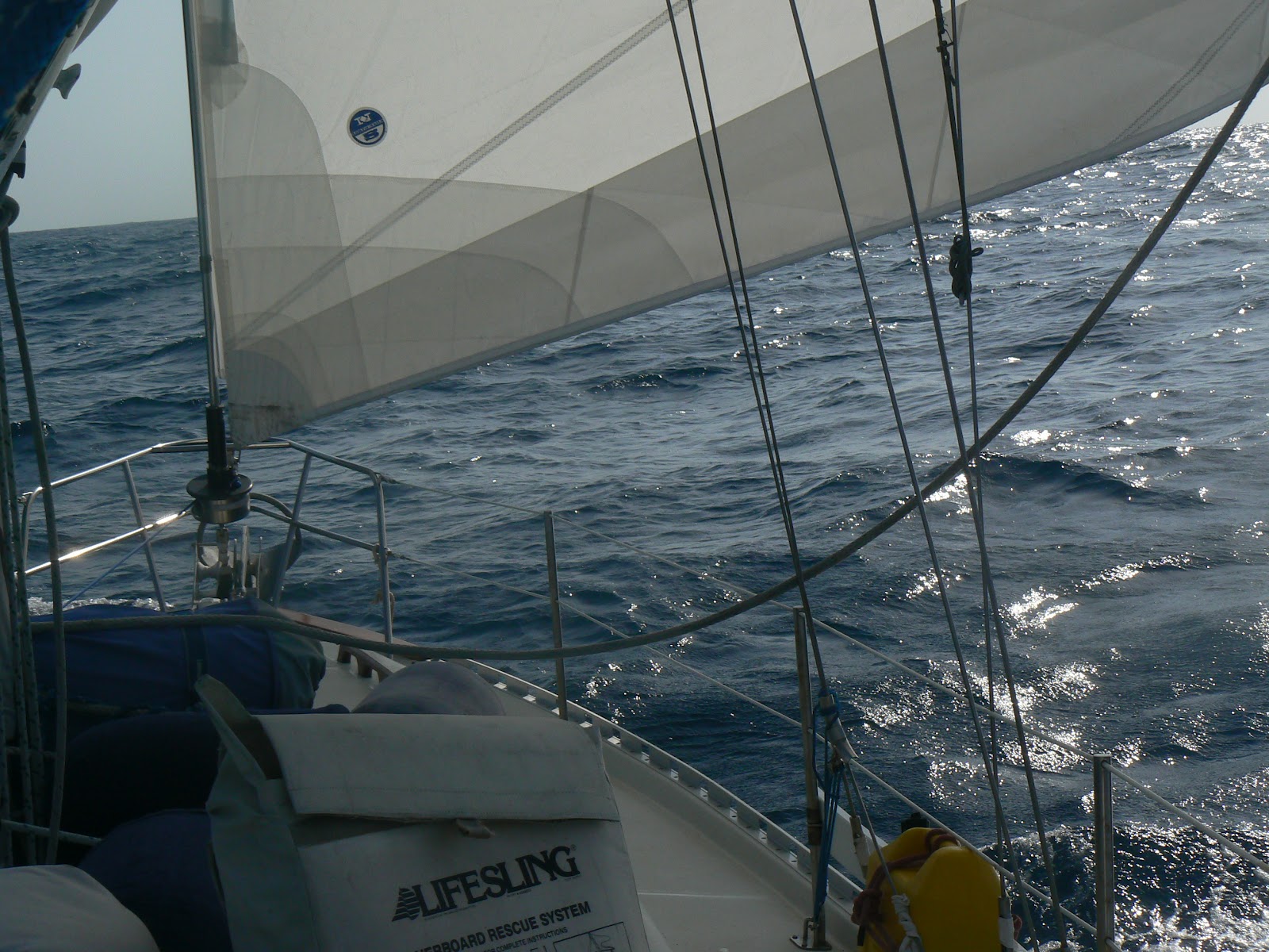 |
| Sailing to the Galapagos |
 |
| The Dalrymple Rock before you get to the island |
 |
| First sights of the Island |
 |
| First sight of the Island of San Cristobal. |
 |
| Coming in to anchor. |
Thursday, March 1, 2012
On to Shelter Bay Marina to get ready for the Canal crossing.
 |
| Big cargo ship waiting to go through the canal. |
 |
| On the way to Shelter Bay Marina. |
 |
| Almost There. |
 |
| Hugh cruise ship going through the canal. |
 |
| Still going through. |
Last few pictures of the San BlasIslands and heading towards the Pacific.
 |
| Kuna Child |
 |
| Kuna children playing in the village of Nargana |
 |
| Turkey Buzzard. |
 |
| Kuna Boat |
 |
| These next two picture are for my good friend Deloris Jones |
 |
| This also is for my friend Deloris. |
 |
| The city of Portobello which Panama Atlantic side. |
 |
| Part of the Fort in Portobello. |
LAS PLAYITAS ANCHORAGE
February 15 - March 2, 2012
We have been in Las Playitas for almost two weeks. John and Karin left on Monday February 20th for their return to "Auburn Angle" in Marathon, Fl. It was a wonderful time with them and we would have taken them onto the Marquesa Islands. It's not easy to have four people living on a small boat but we made it work. Thank you John and Karin!
Las Playitas (8-54.5' N x 79-31.5' W) is just outside of a marina by the same name. It is on a peninsula that is joined by a causeway called Amador. Las Playitas is on the North side and there is another anchorage called Las Brisas on the South side. During the dry season (December to May) the North side is preferred and during the wet season (May to December) the South side is the better one. The Las Playitas anchorage is very "rolly" from all the traffic that is entering or exiting the Canal. Additionally, there are several launch boats that go out to the anchored ships carrying passengers and supplies. They have no mercy in cutting back on their throttle and seem to take a devilish delight in rocking the yachts at anchor. Nevertheless, for $35 per week, we have dinghy access to the Las Playitas Marina where we can get water, fuel and taxi cabs into Panama City. There is free WiFi not too far from the marina and we walk there almost every evening. During our last week here we found out that we could have our phones charged up with a Simm card and internet access for less that $10. Additionally, we got 100 minutes to the States for $1.99.
The last few week have been very busy with shopping, shopping, shopping. Panama City is a great place to shop. It's like being in the States. They have almost everthing one could ask for. It will be the last place where we will find this kind of food for a long time. We have supplied the boat with at least a four month surplus. This will take us to Papeete, Tahiti. All we need are fresh vegetables in the Galapagos and Marquesas. We will catch fish along the way and buy meat after we enter ports.
It has been necessary to have a French Agency in Papeete post a bond for our entry into the Marquesas. Additionally, we had to find a cheap medical/evacuation insurance policy: DAN insurance solved this. The French will allow 90 days in a six month period for tourists. We would like to stay longer and try to haul out and go back to the States for the Typhoon season rather that sailing to New Zealand this year. We'll have to see what can be done.
The Galapagos present no special difficulties. An agent is needed and now boats can only anchor in a few designated places. We will do this and take a tour boat along with the rest of the visiting tourists. The cruising world has changed during the last thirty plus years and not for the better in many cases.
Tomorrow March 2nd we sail from Las Playitas for the Galapagos Is: 850 nm. We will stop at Contadora (8-37.2' N x 79-02.1') in the Perlas Islands for an evening to rest. I figure it will take 10-14 days to get to the Galapagos as the winds become very light or non-existent near the equator. We do not carry enough fuel to motor so we'll take what comes along. All this means that there will be no blog for several weeks.
PORTOBELLO TO COLON AND PANAMA CANAL TRANSIT
February 10, 2012
It's only 25 nm from Portobello to Colon so we heaved up anchor at 0800 hrs and were in Colon at Shelter Bay Marina in the early afternoon. Now comes the hectic part of making arrangements for a transit through the Panama Canal. Like everything else in life, there is an economical way to do this and a more expensive convenient way. Assessing the situation at hand, I had to act quickly in order to have John and Karin as line handlers in the transit. It's Friday afternoon and the Admeasure's Office will be closed until Monday. This is the first step in setting up a transit: get the Admeasurer to work out all the calculations. Fortunately, I ran into a most excellent agent named Roy Bravo at the Shelter Bay Marina. He offered the following solution for a scheduled transit. Pay the overtime and have the Admeasurer come out to the boat on Saturday: 2 hr min @$85 per hr = $170. If I were to do this, I could get the boat scheduled to transit the Canal on Tuesday. The agent's fee will be $400 and the Transit will be $650 plus sundry other expenses. The final tab for all expenses was $1501 Here is what has to be done to transit the Canal:
1) Get the boat measured: length, beam, draft, tonnage
2) Have four 125' lines: these can be rented @ $150.
3) Have at least four tires for fendering: agent provided these "free"
4) Have four line handlers onboard: I had John, Karin, Phyllis and had to hire the extra line handler at $60 per day for two days. Line handler sleeps onboard and has to be fed.
5) Once the scedule is set, the vessel is anchored in the "F" anchorage and awaits an "advisor" at a designated time. Advisor and Line Handler are to be fed and provided nourishing drinks.
6) Get "zarpe" (Clearance Permit from Colon to Balboa)
7) Mariners Visa
So I paid the overtime to the Admeasurer and received a tentative transit time of 1600 hrs on Tuesday. We left Shelter Bay Marina at 1345 and dropped anchor in the "F" anchorage. The "Advisor" boarded Solstice at 1600 hrs and we heaved up anchor and proceeded to the Gatun Locks. Gatun Lock has three chambers that pick up the vessels to a total height of 85 ft. In each chamber one is lifted about 28 ft. We entered behind a large ship and took a "center chamber tie up". This means that the four line handlers are thrown light lines which they tie onto the bigger 125 ft lines which are hauled up onto the lock walls by dedicated lock personnel. This holds the vessel in position while the locks are being filled. This is "up locking" and the most difficult. Our line handlers, John, Karin, Phyllis and Eric, will keep taking up the slack of the lines as directed by the Advisor. The water is turbulent and fast so tension has to be kept on the lines: haul in, haul in, haul in. As long as tension is kept on the lines all is well. Should a line break the Captain will have to use the boats engine to hold position. In our case all is well. We have a good advisor, center chamber tie up and good line handlers. After each chamber is filled the gate is opened and the big lines are taken in but the smaller ones are still attached and are walked along the locks on the port and stbd. sides by dedicated lock personnel. This is repeated in the next two chambers. In the last chamber that feeds into Gatun Lake, the small lines are detached from our bigger lines and when it's time to exit a horn sounds and our lines are thrown off and we exit the lock into Gatun Lake.
Gatun Lake feeds the fresh water for the locking system. It is an artificial lake that huge and deep: 20 miles long and many miles wide. It has enough water to keep the Gatun Locks operating 24 hrs per day 365 day a year: millions and millions of gallons on water.
Once we exited the last lock we are taken to an overnight anchorage. The Advisor gets off and goes home. The line handler stays and sleeps onboard. Total time for picking up anchor in the "F" anchorage and locking through the three chambers of Gatun Lock and dropping anchor in Gatun Lake was 2 hrs 24 minutes. The actual locking through the three chambers took only one hour!! Had we been a big ship they would have had locomotives pulling the ship through the locks: 4, 6, or 8 locomotives per side depending on size. This provides perfect control of the vessel.
Day 2
The Advisor arrived at 0615 this morning. We heave up anchor and proceed to the Pedro Miguel and Miraflores Locks. It takes about four hrs to motor through Gatun Lake and Galliard Cut before reaching the locks. Sometimes they are in a hurry and you have to push the engine to make the time. In our case it was a very easy slow paced affair. Gatun Lake is beautiful and we enjoy the scenery.
We enter Pedro Miguel Lock at 1200 hrs. Once again it is a "center lock tie up". Down locking" is much easier since one is letting out line. Pedro Miguel lock drops us down thirty feet. It is a single lock. Once the gate opens, we motor about a mile to the Miraflores Locks. Depending on the Pacific Tides which can exceed 16 ft, there are two chambers that drop the boats down about thirty feet in each chamber. The procedure is the same with the line handling but line is payed out instead of heaving it in. Miraflores lock has a camera that views all ships coming through. If one knows the approximate time of entering, they call tell their friends and relatives anywhere in the world and they can access the Miraflores website and watch the ships coming and going. We did'nt know the time and had no internet access.
We exited the Miraflores Lock at 1312 hrs and dropped anchor in Las Playitas anchorage at 1430 hrs. Las Playitas is just off the main Canal channel about five miles outside of Panama City.
EL PORVENIR TO LINTON ISLAND AND PORTOBELLO
February 7, 2012
I made the official check out yesterday and received our "zarpe" (clearance paper) to Colon via Linton island and Portobello. We heaved up anchor at at 0630 and set sail for Linton Island which is about 45 nm to the West. The wind is out of the NE at 15 kts and the seas are around 8' in big swells. We are running to the North of the Escribano Banks which are about 7 nm offshore. It is a good sailing day.
We arrived in Linton Island at 1730 hrs and dropped anchor (9-36.7' N x 79-35.2' W) in 40 ft water with 180 ft chain out. Linton island is surrounded by high mountains and we could here the cries of Macaws and other wildlife. There is a band of monkeys on the island which are the only inhabitants. It is reported that they are friendly and will approach and sit in you lap but once they determine that you are leaving, they become upset and may bite. After our experiences with monkeys in Nepal at the Monkey Temple, we want nothing to do with them. One can view them from a distance without physical contact. In Nepal, it was necessary to carry stones with you to keep them away.
Linton was just an overnight night stop for rest and we didn't go ashore. The following morning we heaved up anchor and proceeded to Portobello which is only 8 nm to the West. Portobello (beautiful port) was once the depository of all the gold that the Spaniards were looting from as far away as Peru. It was brought here and loaded on the galleons enroute to Seville, Spain. The city was fortified with walled fortresses and cannon but that didn't stop the famous pirate Capt. Morgan from breaking through the barriers and looting the city. With 460+ men he was able to overcome the Spaniards and decimate the city. It was rebuilt and fortified with more cannon and wall but, once again, an English privateer named Vernon was able to burst through the defenses. At this point, the Spanish lost faith in Portobello and moved their ill-gotten gain to Nombre de Dios which was easier to defend.
Today Portobello is a very small town stretched along the water's edge with very little to recommend it other than history and magnificent walled fortresses with cannon. These walled fortresses are formidable and it's hard to see how they were breached by ships entering the harbor.
We took a very colorful bus to Las Sabanitas, which is about 35 miles away, to do some shopping. It's easier to do it here rather than in Colon. Foreigners refer to these buses as "Chicken Buses".
Tomorrow we leave for Colon.
COCO BANDERO CAYS TO HOLLANDES CAYS
February 4, 2012
The Coco Bandero Cays were just isolated enough that the Friday "veggie boat" didn't make a stop. We'll make do with what we have aboard until we reach Portobello.
We weighed anchor at 1042 hrs this morning and set sail for the Hollandes Cays (9-35.1' N x 78-41.6' W). These cays are considered by many to be the most beautiful and have the clearest waters in all of the San Blas Islands. This can be disputed by those who have cruised around here for years. Anyway, they are magnificent and teaming with fish, conch and lobster. Since they are one of the most Northerly group of islands, the waves are roaring and breaking over the reefs. Such awesome power! to see ten ft swells bursting over those reefs. Although the inner lagoons are calm, there is quite a bit of current running through this area. Cruisers mainly anchor at two places: The Swimming Pool and the Hot Tub. The Swimming Pool is closer to the reefs and has a better breeze than the Hot Tub. For those that need the wind power for their wind generators, it is the chosen place to anchor. The Hot Tub is more protected but has less wind. Also, there is a very tight entrance with reefs protruding on both sides. This is where the "navigation team" shines: Karin and John are on the bow visually spotting the reefs and relaying info via the VHF radio to me while I am sitting at the chart table and watching the plotted course on the electronic charts. I give helm orders to Phyllis and she keeps the boat on course. Whatever Karin and John see takes precedence over everything else. GPS and electronic charts are great but there is nothing so good as "eyeballing" it. This will be crucial to navigating in the South Pacific islands. The San Blas area was a great place to start.
We anchored in the Bath Tub (9-35.1 N x 78-41.6' W). There are quite a few islands in this group along with various reefs teaming with fish. It is here that we met Bruce and Marcell on their Tayana 37 "Adventure Bound". Karin and John have a Tayana 37 so it was a natural attraction. Additionally, Bruce was a very experienced diver and speared some beautiful fish. He speared a big Trigger Fish which I filleted. There was enough for everyone and it was delicious. Grouper and Mahi Mahi are favorites but this falls right in place as a most delicious fish.
The Hollandes were the final great cruising cays we would see on this most interesting and beautiful cruise through very remote areas. We give our gratitude to Scott and Kitty on their Valiant 40 "Tamure" for directing us here as a "MUST". If not for their persistence in stating that "you have to see the San Blas Islands", we might have gone directly into Colon and made the transit through the Canal.
We heaved up anchor on Feb 6th and sailed back into El Porvenir for checking out. If you check in at El Porvenir officially you have to check out of there for Colon.
NARGANA TO RIO AZUCAR AND COCO BANDEROS CAYS
February 3, 2012
Weighed anchor at 1045 this morning and proceeded to to Rio Azucar for fresh water. Although we have a water maker onboard that has an output of three gallons per hour, we are four persons and I have to run it around three hours a day to keep up with demand. Whenever I can get fresh water, I'm happy to take it on. Rio Azucar is one of those places where they have a dock that provides fresh water from the Rio Diablo. It is on the leeward side of the island and coming alongside one has to be careful not to knock over one of the "outhouses" on the bow very close by. Other than water, Rio Azucar has very little to recommend it. We loaded our water and left for the Coco Banderos Cays which are 8 nm Northwest.
We departed Rio Azucar at 1342 and dropped anchor in the Coco Banderos Cays (9-30.6' N 78-37.1' W) at 1530. This group of cays is remote with few yachts but stunningly beautiful. There is a Kuna on one of the islands that was a former Mormon missionary and spent quite a bit of time in Salt Lake City, Utah. He is building a beautiful thatched roof restaurant on one of the islands and has ambitious plans for attracting yachties. He indicated that he was a "beer" drinking Mormon and no longer associated with the church. We wish him luck with his restaurant but can't see how he will succeed in a place that has such limited anchoring for visiting yachts.
We did a lot of swimming, snorkeling, exploring and collecting shells on the Coco Banderos Cays. It was a wonderful time spent with our good friends John and Karin. Every island is a treasure onto itself. We can see that global warming is starting to overwhelm many of the low islands in the San Blas area. Many remnants of coconut trees are seen under water where there was once land.
GREEN ISLAND TO NARGANA
January 30, 2012
We departed Green Island this morning at 1100 hrs and sailed over to Nargana. Once again the distance is short: 5 nm. Dropped anchor at 1222 hrs on the South side of Nargana anchorage (9-26.5' N 78-35.2' W). Nargana is a very unique place in Kuna Yala because the Kunas living here have decided to give up many of the traditional Kuna ways of living and adopt a more modern attitude. Secondly, there are two islands that have been joined with a bridge between the two islands: Nargana on one side and Corazon de Jesus on the other. Although joined by the bridge they maintain separate village chiefs. Corazon de Jesus has a small regional airport with flights to Panama City. Like all other Kuna villages, Nargana only enjoys fresh vegetables once a week when the 4 x 4 jeeps bring them from Panama City. Nevertheless they are available on a "wilting basis" throughout the week. Dry stores and booze is always available along with the delicious Kuna bread. Nargana gets its water supply from the Rio Diablo river whose entrance is only a quarter mile away. The water comes via 6" PVC piping from a waterfall that is about six miles upriver but crosses the Rio Diablo at about three miles and then wends it way over land and back under the sea to the the village. At the time we were there the pipe had been broken for almost four months and delivered no water to the villagers which number at least 1200 persons between Nargana and Corazon de Jesus. Not to worry, the locals were making constant trips from the island to the mainland in their "cayucos" and hauling water back and forth. This is a three mile trip up the Rio Diablo to where the PVC piping crosses the river. Also, it ensures fresh clean water with no salt contamination from the sea. Back and forth, back and forth they paddle or motor the cayucos to provide water to the village.
We decided to go up the Rio Diablo in our dinghy to see where they were getting their water. It is a beautiful trip up a scenic river. Along the way we passed some farming plots and Kuna cemeteries. Finally, we reached the water source where the PVC waterline crosses over the river. It was here that everyone was filling barrels, water jugs of all descriptions and anything else that was available. It is an amazing feat to provide water to two villages via dugout canoes on a daily basis. We were told that the pipe line was in the process of being fixed and would be delivering water in a few days.
While we were Nargana, we saw a sign that said "beer sold here". I knocked on the door and a very friendly Kuna came out and invited us into the back of his home to sit at a table under a thatched roof. He was a former government employee and well educated. He explained the modern ways of the Kunas living in Nargana and explained that his daughter was studying at the university in Panama City. In the past is was forbidden for a Kuna woman to marry outside the race, however, in Nargana this is no longer true. It still holds true for the Kuna following traditional ways. Before we left his home, he gave us bananas, coconuts, limes and mangoes.
Since we couldn't get water in Nargana, we decided to go to Rio Azucar which is only 3 miles away. Nargana is as far East as we will cruise on this trip. We will now start to head back West until we check out at El Porvenir and start making our way back to Colon and the Panama Canal transit.
Subscribe to:
Posts (Atom)