Tuesday, April 18, 2017

Clifton Harbor, Union Island

We rented a mooring in Clifton Harbor so we didn't have to anchor. Clifton itself was very disappointing. It was not very clean and very expensive.  We had read that it was would be interesting. But not so for us.
They did have colorful fruit and vegetable stands.


We ate at this restaurant  that had  Hughes fish tanks with the Hughes lobsters we've ever seen and the food was good.

Monday, April 17, 2017

Carriaco

From Prickly Bay to Carriacou to check out of Grenada.
We had Sunday brunch at the slipway restaurant. 

This was there sign at the dinghy dock.

Don 's Mahi mahi meal. He said it was very nicely cooked.

I had fish tacos that was the best.

The bay  we anchored in.

On to Prickly Bay.

Once we got to Grenada, we med moor which means we go stern first to the dock which is not so good for us. Fortunately  our friends were next to us so we rafted and we could get of our boat. But once they went on the hard we had to use our dinghy to get of to go to the showers and bathroom. Not pleasant. The only reason we were there was to get a few things fixed. Did not take any pictures of Prickly Bay.
Sunset on the way to Grenada. It wasn't a great sunset.


We had a leak in the galley for a very long time and couldn't figure out where the water was coming from. And it was salt water. So we took a few things apart where we finally figured out where the water was coming from. Between the scuper and the through hull. There was a leak in one of the hoses.

Don had to climb into the dry locker that is about 3ft deep and about 2ft wide.

And there he goes climbing in to replace the hose.

Squeezed himself in. And fixed it. No more leak. What a good husband to put himself in such an awkward  position.


Sunday, April 16, 2017

BEQUIA, GRENADINES

BEQUIA, GRENADINES
APRIL 13- 18, 2017


The distance from Clifton Harbor, Union Island to Bequia is 37 nm.  The day we departed, the wind was out of the ESE 15-18 kts; seas 3’.  This gave us perfect conditions to fetch Bequia in one tack after clearing Union Island.  We departed Clifton at 0724 hrs and dropped anchor in Bequia at 1400 hrs: (13-00.612’ N; 061-14.608’ W). It was one of the best sails we have experienced under a double reefed main and genoa.  I kept the double reefed mainsail because, running up the leeward side of the islands, strong katabatic wind gusts rush down the mountains and ravines heeling the boat over.  I smile and enjoy it with a monohull but, in 1978, with the Wharram Catamaran, it was a concern because a catamaran will not heel to spill the wind therefore the rigging is vulnerable.

I have been trying to reminisce and put together just where we anchored in Admiralty Bay in 1978 on the 40’ Narai Mk IV Wharram Catamaran.  We took a dinghy ride today around the entire bay and have decided that it was in Lower Bay: 12-59.842’ N; 061-14.717’ W.  It is the only place that has the remaining coconut trees that I remember.  At that time, we had a friend named Gary Gilbert that was crewing for us.  We had picked him up at Bridgetown, Barbados.  He would become a lifelong friend.  Also, if memory serves me well, we had taken on a couple whose marriage was falling apart.  At that time, I was still playing guitar and the man taught me the words and music to Fats Waller’s song “Black and Blue”.  Phyllis was pregnant but didn’t know it.  There was a Frenchman named Philipe who had built a boat on Isla de Lobos in the Canary Islands.  We met him and then Gary and I walked over the mountain to the windward side of Bequia and caught six large lobsters.  That evening, we had a feast on the beach with Philipe and locals.

I don’t remember the town of Bequia at all.  That isn’t so surprising because we didn’t have any money to spend there.  Also, I can only recall a few boats where we anchored; one belonged to Philipe and he had a stern line running to a coconut tree.

Bequia today remains an island of sailors and boats linked to the outside world mainly by the sea.  The island still has an active whaling station in a low-key and traditional way.  They are allowed to take four whales a year but don’t  get many because few people are left with the skills necessary to hunt them – a daring feat in an open sailing boat, using hand thrown harpoons.  Bequians continue to build their traditional wooden double ended sailing boats in the shade of palm trees and sheds.  As I am writing this, it is the annual Easter Bequia Regatta that began today (April 14th and goes through Sunday April 16th).  The first race today was in Admiralty Bay; tomorrow they sail to Friendship Bay; on Sunday all the way around the island.  Lots of sailors here and cruisers are allowed to participate in their own class.  We don’t race.

In contrast to Clifton Harbor, Bequia is clean.  There is a sense of civil pride in the locals.  They are proud people,” descendants of settlers who came from North America on whaling boats, from farms in Scotland, from France as freebooters, and as slaves from Africa”.  This French freebooting has a long history and is alive and well today in the cruising world.  I think there is a mooching gene involved.  Nevertheless, I admire the intelligence, originality and courage of the French sailors we have met.

Bequia is a town of local artists, restaurants, fruit and veggies markets, boat building supplies, tour guides, dive shops, supermarkets, etc.; just about anything you might want can be found somewhere.  The Rastas are doing well in the Veggie Market and the smell of ganja is enticing.  Most of the businesses are owned by locals with a smattering of foreigners.  It appears that there is enough money flowing around to keep everyone solvent.  There is a feeling that they like you as well as the money you bring.  I didn’t get that feeling at Union Island.

Sinc we have arrive during the Easter festivities, Customs and Immigration will not be open until Tuesday April 18th.  Originally, I was going to check out at Chauteaubelair on the west coast of St Vincent and then sail to Marigot Bay at St Lucia.  Given the delays, we will check out here in Bequia and sail directly for St Anne’s Bay (14-26.064’ N; 060-53.512’ W) on the island of Martinique: 90 nm.  If we leave here at 1500 hrs on April 18th, we should arrive at St Anne’s Bay around 0900 hrs on April 19th.


UNION ISLAND, GRENADINES

UNION ISLAND, GRENADINES
APRIL 11-13, 2017

We set sail from Tyrell Bay at 0818 on April 11th.  It’s a short hop of 13 nm from Tyrell Bay to Clifton Harbor, Union Island.  This is the administrative center for the Grenadines because it is a Marine Park that encompasses the Tobago Cays (not to be confused with the island of Tobago).  These Cays reputedly offer some of the finest snorkeling and diving to be found anywhere.  They are protected from the sea by Horseshoe Reef but still open to the full force of the ocean winds.  The St Vincent and Grenadines Park Service charges about $US 4 per day per person.  Mooring are available for $US 45 per night. We didn’t have time to go into this area and Phyllis doesn’t snorkel so it wasn’t worth the time.

WE picked up one of the National Park Service Moorings (12-35,793’ N;061-24.836’ W) in Clifton Harbor: $US 22 per night.  The moorings are well maintained and strong.  Given the amount of traffic that is buzzing around, I felt that the mooring was the best bet but I could have anchored.  In addition to the Tobago Cays, Clifton Harbor is protected by a reef that shows off its brilliant kaleidoscopic colors and patterns as you sail in.  The expanse of brilliant green-turquoise and brown are stunning. 

Once we were moored, our eyes caught this amazing display of kiteboarding.  It appears that Union is the kiteboarding center of the Windward Islands.  Unfortunately, Clifton is not as beautiful and pristine as its surroundings.  It has a colorful picture- perfect market around a green and some small buildings that, architecturally, are interesting.  Outside of this, the town has a run-down dinginess that is hard to forgive.  The locals don’t seem to have that special “Keep Clifton Clean” attitude.  There are some good restaurants and eateries as well as hiking trails.  We only had a very small view of the whole so, maybe, there is more to recommend it.

Given that this town is totally dedicated to tourism arriving in planes and boats, it isn’t surprising that the prices reflect the clientele.  I tried to buy a small 10 lb watermelon and, after bargaining, could not get the price below $US1.50 per lb so I walked away.  Tuna, Conch and Mahi-Mahi are caught daily and cheap.

We departed Union Island at 0724 hrs on April 13, 2017 for Bequia.  In 1978, on the 40’ Ocean-going Wharram Catamaran that we had spent six years in the Canary Islands building, Bequia was as far South in the Windward Islands that we sailed.  After that, we sailed north to Martinique and Antigua.  We are now picking up that track again and, as before, will make a landing on the east Florida coast.


CARRIACOU, GRENADA

CARRIACOU, GRENADA
APRIL 8-11, 2017

We departed Prickly Bay at 0718 hrs.  We had shifted from the Marina to one of their mooring buoys the day before so that we could get an early start.  It’s only 37 nm from Prickly Bay to Tyrell Bay on the island of Carriacou.  Enroute, about 5 nm north of Grenada, there is an active submarine volcano named Kick ‘em Jenny.  The government of Grenada has established a 1.5 km exclusion zone around it.  If they detect signs of rumbling, the zone is increased to 5 km.  Since there were no warnings issued, we infringed upon the exclusion zone to make our course line into Tyrell Bay.  The sail was pleasant with wind from the E 15-20kts; seas 4-6’.  We made fast to the mooring at 1630 hrs: 12-27.410’ N; 061-29,199’ E

Upon entering Tyrell Bay and preparing to anchor, a boat from Carriacou Marine Services approached and offered us a Mooring Buoy.  I had the anchor ready to drop but decided to take the mooring buoy for the two nights we were going to be there.  These mooring buoys are not cheap:  US$15 per night!  In fact, the Caribbean is not bargain priced.  Over the years yachts have grown bigger and their owners more affluent.  The tourist market reflects this affluence and locals know that money can be made from goods and services to the yachting community.

Tyrell Bay is another one of those beautiful places that yachts and tourists love to visit:  Beautiful sandy beaches under palm trees and friendly welcoming locals.  There are a few good restaurants and all offer free WiFi which is good.  Once again there is an active Cruiser’s Net on VHF 69 at 0730 hrs in the morning.  Hillsborough is the largest city and located about three miles north of Tyrell Bay.  It has just about everything the cruiser needs but is not as good as St George at Grenada.

One could spend more time in this lovely bay but we are now heading north, up the island chain, and over to the USVI’s.

PRICKLY BAY, GRENADA

PRICKLY BAY, GRENADA
MARCH 28- April 8, 2017

We set sail from Charlotteville, Tobago at 1742 (UTC-4) hrs on March 27 and arrived Prickly Bay Marina (11-59.907’ N; 061-45.550’ W) at 1154 (UTC-4) hrs.  It was a very pleasant sail with the wind out of the ESE and seas running 4-6’ with a clear starry night.  We were able to set the two poled out jibs and maintain about 5 kts.  We had a one kt current against us.

Prickly Bay has many contractors and marine services that cater to the yachting world.  Spice Island Marina has haul out facilities, small apartments and a very good Chandlery named Budget Marine.  It is centrally located and St George is a ten minute bus ride.  There are some big supermarkets in St George including an IGA.  Everything can be found to provision a yacht.  WE had to go to Prickly Bay for a Freon leak in the refrigeration unit and a leak in the floor of our Avon dinghy.

We had to “Med Moor” at the Prickly Bay Marina.  This consists of picking up a fixed mooring buoy for the bow of the boat and backing onto the pontoon and putting out two stern lines.  It doesn’t work well for a canoe stern boat because we weren’t able to get off.  Our friends on “Norsa” were next to us so we pulled ourselves alongside them and used their boat for getting on and off.  Once they left, we had to use our dinghy and go over to the dinghy dock to get on and off the boat.  We won’t Med Moor anymore unless it is absolutely necessary.

There are some beautiful bays on the Southern end of Grenada:  Clarks Court, Secrete Cove, Whisper Cove and Hog Island.  Many cruisers return to these beautiful places year after year.  There is an active Cruiser’s Net that comes on VHF 66 at 0730 hrs every morning except Sundays.  It is informative and helpful.  Just about anything can be arranged by requesting it.

Many yachties from the UK haul out for the hurricane season and fly back home.  Others stay and make arrangements to find a good “hurricane hole” should one threaten.  Grenada is slightly South of 12 degrees which means that the island is not frequented by tropical storms very often.  Grenada is a beautiful, friendly and welcoming place.  It values the yachts that choose to call there.

Monday, April 3, 2017

On to Tobago.

 From Fernando de Noronha to Tobago, it took us 15 days sailing,  with overall good weather. We went in to Charlotteville to check in. This place was recommended  from another cruiser and what a great place. Very laid back , a very good friendly and anchorage. We spent 5 days touring and interacting with the locals. We were also able to buy fresh vegetables  and fruits. All in all it was a great place to stop.
First 4 pictures are of sunsets and after  sunsets on the way to Tobago. 


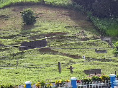
Cemetery on the hill.
Local lady coming back from church with grandson.
Fishing nets out to dry.
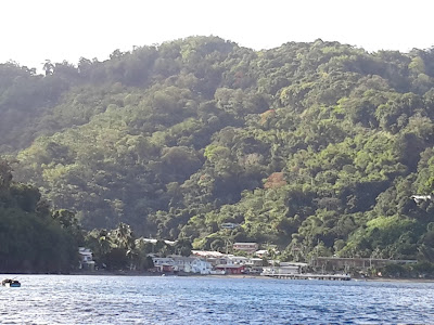
Pictures of Charlotteville
seagulls and pelicans.
Lots and lots of seagulls and pelicans on the beach.

This is a beautiful cruise ship.Now I wouldn't mind taking a cruise on  her.
Taken from Solstice at anchor night before we left for Grenada.


 These two picture were taken coming in to Tobago.

You can see the hole better on this picture. The back ground is St Giles island.
This is our first place we went to after checking in with custom and immigration. The lady in the back ground,  Layada made us a rum punch.

CHARLOTTEVILLE, TOBAGO

CHARLOTTEVILLE, TOBAGO
MARCH 24-27, 2017 

We dropped anchor (11-19.805' N; 060-33.156' W) in Charlotteville at 1330 (UTC-4) hrs on March 24th, 2017 after a 1933 nm passage from Fernando de Noronha.  Charlotteville is tucked away on the NE corner of Tobago.  It is a small village with brightly painted pastel colored houses.  The locals are friendly and welcoming.  They enjoy the laid back, easy going pace of the village.  There are a few restaurants and bars in the town but not much else.  We saw a Diving Shop and local fishermen will take tourists out for a fishing trip.  The village is made up of local fishermen that can catch big tuna not too far offshore.  There is a fish market that processes them for shipping elsewhere.  The clear in/out procedure with Customs and Immigration is easy: US$23.  My guess would be that there are less than 300 people living in the surrounding area.  The total population of Tobago was given as 54,000 by their census bureau. The best restaurant in Charlotteville is “The Suck Hole”.  There is another small organic restaurant called “Lucille’s”.  We didn’t eat there but, I believe, it is very good.  On Friday evenings, the Pentecostals/Baptists take over the public square and organize a religious gathering with a Band and boom boxes. It appears to be an old time revival gathering that lasts until late at night.

We rented a car with our cruising friends from “Norsa” –Norman & Sara- and toured the island.  The northern leeward side of the island is densely forested, mountainous and very green.  There are a few places where one could safely anchor overnight.  Along the way, there were a few coves and sandy beaches with restaurants.  Stone Haven would be the next best place after Charlotteville for an extended stay.  Along this stretch of coast is where the endangered Leatherback, Hawksbill and Green turtles come to lay their eggs.  The locals protect their nesting sites.

The southern windward side of Tobago is more populated than the leeward side.  Scarborough is the capital and main shopping center.  From what we have seen, it would not be a good place to anchor and check in.  Most yachts go around to Stone Haven or Charlotteville.  It is cooler and drier on this side of the island with the wind blowing from the ESE-E.  There are many small towns starting from Scarborough to Charlotteville.  Transportation is by minivan and prices based on distance.  We paid about US$6 for a one way trip to Scarborough.  It’s a long narrow winding road and takes about one hour fifteen minutes to go 45 km.  The drivers we had were skillful.

While we were in Charlotteville, a beautiful five masted sailing vessel, “Sea Cloud”, came in and anchored:  Stunningly beautiful with a full set of canvas for sailing.  After that, a cruise liner anchored for a day.  They provide some income for the town but, I believe, that most are carted off to tour other places on the island.

Tobago is a good stopover to somewhere else.  It is quiet, beautiful and welcoming.  If one likes hiking, snorkeling, diving and fishing, it is a great place to spend some time. We found that the town of Speyside, about 5 km from Charlotteville, had a few good restaurants.


We set sail from Charlotteville to Prickly Bay, Grenada at 1742( UTC-4) hrs on March 27, 2017.  It’s only 84 nm away so we planned an overnight sail with morning arrival at Prickly Bay.

Sunday, April 2, 2017

FERNANDO DE NORONHA TO TOBAGO

FERNANDO DE NORONHA TO CHARLOTTEVILE, TOBAGO
MARCH 9 – 24, 2017
We set sail from Fernando de Noronha at 1130 hrs (UTC-2) on March 9th bound for Ile de Salute (1320 nm) or Charlotteville, Tobago (1933) nm.  The idea of going to Ile de Salute was to break up the voyage and visit the prison where Papillion had spent so much time.  Several interesting things were going to happen on this voyage:  we would cross the equator and enter the Northern hemisphere; we would sail through the ITCZ (Inter-tropical Convergence Zone) commonly known as the doldrums.  The ITCZ is an area where the SE Trades and NE Trades meet producing thunderstorms, squalls, torrential rains, calms, strong winds and other meteorological phenomena.  This band of disturbed weather runs from the Amazon River Basin all the way to Sierra Leone on the African coast.  It’s North/South latitude changes from season to season but lies within 4 degrees North to 4 degrees South.  A sailor tries to pick the narrowest part of the ITCZ and get through it as quickly as possible.  If there are calms, one motors; wind, on sails; thunderstorms, drop sail or reef; confused seas, make the best of it.

Here is a rundown of the sailing distance made good:
March 10th  134 nm   Avg. Speed = 5.4 kts   Noon-Noon    DTG = 1799
March 11th  108 nm   Avg. Speed = 4.4 kts   Noon-to-Noon           1691
March 12th  109 nm   Avg. Speed = 4.4 kts   Noon-to-Noon           1582
March 13th  111 nm   Avg. Speed = 4.5 kts   Noon-to Noon           1471
March 14th  127 nm   Avg. Speed = 5.2 kts   Noon-to-Noon           1344
March 15th  117 nm   Avg.  Speed = 4.9 kts  Noon-to-Noon           1227
March 16th   97 nm    Avg. Speed =  4.0 kts Noon-to-Noon            1130
March 17th  113 nm    Avg. Speed = 4.7 kts Noon-to-Noon            1017
March 18th  137 nm    Avg. Speed = 5.7 kts  Noon-to Noon             880
March 19th  145 nm    Avg. Speed = 6.0 kts  Noon-to-Noon             735
March 20th  159 nm    Avg. Speed = 6.6 kts  Noon-to-Noon             576
March 21st  170 nm    Avg. Speed = 7.0 kts Noon-to-Noon              406
March 22nd  141 nm   Avg. Speed = 5.9 kts  Noon-to-Noon             265
March 23rd  130 nm   Avg. Speed = 5.4 kts  Noon-to-Noon              135
March 24    135 nm   Avg. Speed =  5.3 kts   1330                                  0

As can be seen from the above, the winds transitioned from SE to ESE to E so we had to modify the sail configuration.  We transitioned the ITCZ smoothly but encountered a low pressure system off the Amazon River basin which brought torrential rain and squally winds.  This was a big slow moving system packing winds to 35 kts but very manageable.  We were swimming in our foul weather gear with no way to dry out.  We crossed the Equator at 2400 hrs (UTC-3) on March 13th.  The passing squalls in the Northern hemisphere have more punch to them as compared to the gentle ones found in the SE Trade Winds.


We dropped anchor at Charlotteville, Tobago in position:11-19.805’ N; 060-33.156’ W on a sandy bottom in 45’ water depth.  The small village looks beautiful and inviting.  The voyage from Cape Town, SA is Charlotteville, Tobago was about 5373 nm.

FERNANDO DE NORONHA, BRAZIL

FERNANDO DE NORONHA, BRAZIL
MARCH 5 – 9, 2017

FERNANDO de Noronha is a volcanic island about 220 nm off the Brazilian coast in position:  03-50’ S; 32-24’ W.  It is another one of  those logical stops coming from Cape Town to the Caribbean.  The island serves as a playground for wealthy Brazilians and prices reflect this.  The Brazilian government has designated the island as a National Park and World Heritage Site.  Tourists visiting the island are limited to 400 persons per day.  There are few boats that stop here because the anchorage and environmental fees are high:  $US 123 per day for boat and two crew.  The highlight here would be that the Harbor Master (Sr. Marcos) serves coffee and sandwiches during the check-in process.  He is very hospitable and willing to help in every way.

Given the fact that everyone except yachties are flying in from somewhere, the island is filled with guest houses and restaurants. 
There is nothing cheap here because all have an excess amount of it or they wouldn’t be here.  The restaurants are good.  An average meal costs $US30+.  The best way to get around the island is to rent a Dunebuggy but busses run between certain places and are cheap or cost nothing.  According to Trip Advisor, Bahia do Sancho” has been rated as #1 beach in the world.  We couldn’t verify this because one has to buy a ten day pass for the National Park costing $US65.  We drove around the island in a Dunebuggy and found nothing remarkable about it:  just another enchanted isle amongst the many more beautiful we have seen. 

The one outstanding feature of the island, when approaching by sea, is a huge upstanding single rock formation that looks like a gigantic penis.  As we anchored, it had changed to an American Indian’s face or some other imaginative form.  It is seen from almost every place on the island.  There is not a whole lot to say about the island:  the Brazilians are friendly, the food and drinks good – but expensive.  The anchorage is rolly but the  Brazilian women are beautiful and eye catching in their skimpy bikinis – a blessing to men and that big rock formation:   time to leave.

We set sail for Ile de Salute (Devil’s Island fame) on March 9th at 1130 hrs (UTC-2): 1320 nm.  The other option was to sail directly to Tobago without stopping: 1900 nm.


ST HELENA TO FERNANDO DE NORONHA, BRAZIL

ST HELENA TO FERNANDO DE NORONHA, BRAZIL
FEBRUARY 19 – MARCH 5, 2017

We departed the St Helena mooring field at 1130 hrs (UTC-2) on February 19th, 2017.  This leg of the voyage provided the best downwind sailing we have ever experienced: day after day of constant SE’ly Trade winds blowing 10-20 kts; very few squalls and moderate seas.  It just doesn’t get any better.  “Solstice” is a cutter rigged yacht.  This means that we have a forestay shroud that will accommodate a poled out staysail.  In Phuket, Thailand I had two stainless steel eyes riveted on the port and stbd. side of the mast so that a whisker pole could be clipped on and led outboard at a 90 degree angle.  Additionally, we have a carbon fiber pole on a track that allows the genoa to be poled out on the port or stbd. side.  This translates into being able to sail downwind with a poled out genoa and a poled out staysail.  In a 15 kt wind, the yacht can make 6.5-7.0 kts effortlessly and be very comfortable.  There will be some rolling as each sail pulls and eases but the motion is comfortable.

The great South Atlantic Ocean is a vast oceanic wilderness with few places to stop in case of an emergency.  Several yachts had had problems with their rudders and had to abandon ship and be rescued by merchant vessels.  To add a safety feature to the long passage from Cape Town to St Helena (1700 nm), St Helena to Fernando de Noronha (1736 nm), Fernando de Noronha to Tobago (1900 nm), we agreed to sail with another yacht: a 36’ Malo named “Norsa”.  What this meant was that because “Solstice” is 40’ and “Norsa” is 36’, the bigger boat would have to reduce sail area so that the other could keep up.  Because this was a downwind sailing voyage, we weren’t able to use the twin jibs all the time unless “Norsa” was flying a spinnaker type of sail known as the “Parasailor” which gave them extra sail area and speed.  They were reluctant to do this during the night because of squalls and increased wind speed.  It was a compromise for both vessels.  We sailed together about 1-1/2 nm apart and communicated via VHF radio at scheduled times.  The thought behind this was that, if an emergency occurred, one vessel would be able to standby and assist or tow the other if needed.

The following mileage figures indicate sail reduction by “Solstice” to accommodate “Norsa’s” speed.  If sailing alone, we would have averaged an additional 24 nm per day:
Feb 20th   119 nm     Avg. Speed = 5.0 kts   Noon-to-Noon  DTG =1617
Feb 21st    128 nm    Avg. Speed = 5.3 kts    Noon to- Noon            1489
Feb 22nd   133 nm    Avg. Speed = 5.5 kts    Noon-to- Noon            1356
Feb 23rd    124 nm    Avg. Speed = 5.2 kts   Noon-to-Noon              1232
Feb 24th     129 nm   Avg. Speed = 5.4 kts   Noon –to-Noon            1107
Feb 25th     116 nm   Avg. Speed  = 4.8 kts   Noon-to-Noon               991
Feb 26th     104 nm   Avg. Speed =  4.3 kts   Noon-to-Noon               887 
Feb 27th     119 nm   Avg. Speed  = 5.0 kts   Noon-to-Noon               768
Feb 28th     123 nm   Avg. Speed =  5.1 kts        Noon-to-Noon          645
March 1st   123 nm  Avg. Speed =  5.1 kts         Noon-to-Noon          522           
March 2nd   127 nm  Avg. Speed = 5.3 kts   Noon-to-Noon                395
March 3rd    149 nm  Avg. Speed = 6.2 kts   Noon-to-Noon                246  
March 4th    133 nm  Avg. Speed = 5.5 kts   Noon-to-Noon                113 
March 5th    113 nm  Avg. Speed = 5.0 kts in 22.5 hrs                               0
Total Distance Made Good = 1740 nm in 335 hrs @ 5.2 kts avg.

During this passage, the SE Trade Winds were fully established and never varied much with an average of 15 kts and a ½ -1.0 kts favorable current.  Some adverse current was experienced at times.

Dropped anchor in Fernando de Noronha at 1030 hrs (UTC-2) on March 5th, 2017 on a sandy bottom in 45’ water depth.  The anchorage is rolly but tolerable.    

ST HELENA

ST. HELENA
FEBRUARY 9-19, 2017
St. Helena is one of the most isolated islands in the world.  Everything is brought in by the “RMS St. Helena”.  The islands of St Helena, Ascension, and Tristan da Cunha are part of the British Indian Overseas Territory Administration (BIOT).  The vessel loads goods and produce and passengers in Cape Town, SA, then transports them to the islands.  It takes about two weeks for a round trip delivery.  The stores in Jamestown reflect this time delay by having a wealth of merchandise when the ship first arrives to very little at the end of the two week period.  The “RMS ST Helena” is the lifeblood and true saint in these islands.  Recently, an airport was built on St Helena but, due to wind shear problems and design flaws, only small planes have been able to land.  At the time of this post, no airline company has been willing to take on a contract to land larger planes.  So there it sits, out on a built up flat area, with no traffic.  This has had a significant impact on the local businesses because they had invested money predicated on the planes bringing in tourists.  The island remains isolated with the exception that medical emergencies can be evacuated to Ascension Island and then flown to other countries.

St Helena has other problems for getting visiting yachts and passengers ashore.  There is a continuous ocean swell that is running.  This makes getting from the small ferry boat onto the dock challenging.  The ferry boat comes alongside the stone pier and the passengers have to grab onto one of the several ropes that dangle from an overhead steel bar, then time the rise and fall of the swell and jump off the boat onto a slippery stone landing.  The ferry boat operators are skillful and coordinate everything safely.  The nominal charge for picking up yachties from the mooring field and bringing them back is about US$1.24 at the time of this post:  A most reasonable amount given the expertise and challenges involved.

The mooring field in St Helena consists of 23 yellow and red mooring buoys.  They are professionally laid out with strong chains and a large flat buoy.  There is a large iron ring that the yacht slips a mooring line through and then makes it fast to the boat:  some chaffing gear is required.  The small ferry boat will assist with this operation if they are in the area or requested to do so.  There is a continuous swell running along with currents that turn the vessel in different directions.  Once moored, they are as safe as the mooring lines from the buoy to the boat.  The local port authorities have invested a lot of money in this system and keep it up to specifications by frequent diving inspections.  There is a strange phenomenon that happens occasionally:  large rollers approach the island from the NW-N.  They might produce a swell the is 10-15’ high.  Under these predicted conditions, many moored yachts choose to leave rather than weather it out.  The port authorities issue a “Sevier Wave Warning” and monitor the approaching system.

  Ascension Island is 700 nm  to the NW of St Helena.  This gives St Helena a 24 hours advanced notice of when these abnormal waves will strike the area.  We left the mooring field in one of these warnings and set sail for Fernando de Noronha.  Our first plan was to go to Ascension Is. but the anchorage has been reported to be foul and rolly.  Yachts have had their anchors fouled or lost.  The only interesting thing on the island are the nesting Green and Hawkesbill turtles alongwith a significant “Wideawake” bird population.  We decided that it wasn’t worthwhile.

The rugged barren coastline of St Helena belies a very lush green interior with tropical rainforest and farming.  BIOT and the local inhabitants are trying to protect the native endemic habitat but years of non-regulation have made this difficult.  Termites were brought in from salvaging a shipwreck and cause extensive damage.  The farmers produce enough local meat products for the island and fish are so plentiful that they are exported.  The terrain is mountainous and straight up from the sea.  Jamestown has some interesting architecture from the 18th century.  It is basically a two street town with shops and residences interspersed.  The locals are welcoming and friendly to visitors.  The genetic makeup of the islanders is a mixture of Portuguese, African, Indian and English plus all the sailors that have called there.  Some of the outsiders indicated that there was a lot of inbreeding.
Ann’s Restaurant and Bar is the place that most yachties go for the internet, food and drink or just socialize.  The internet is adequate for emails and research but quite slow for downloading videos.  Also, it’s expensive: $US 6.00 per hour.  I was able to send our US Income Tax without any problems.  Tours and Hikes are available.  There are many trails on all parts of the island ranging from easy to difficult.  The island is a logical stop from South Africa or Namibia going North to the Caribbean or Cape Verde Islands.  It would be a great pity to bypass it.

We departed St Helena at 1130 hrs (UTC-2) on February 9, 2017 enroute to Fernando de Noronha (03-49.9’ N; 032-24.5’ W): 1736nm.


CAPE TOWN, SA TO ST HELENA

CAPE TOWN, SA TO ST. HELENA
JANUARY 26 TO FEBRUARY 9, 2017
We departed the V & A Marina at 0745 hrs on Thursday January 26th for Jamestown, St Helena 1700 nm distant.  It was a beautiful day with light winds so we had to motor about 15 nm to get out of Cape Town and past Robben Is.  The wind was S’ly at 12-15 kts and the seas were less than 3’.  We set a double reefed mainsail and full genoa and started to sail at 6 kts; very pleasant sailing conditions.  The wind held in the South but the seas started to increase to about 7’ which is just fine for this part of the world.
The run from Cape Town to St Helena is called “The Milk Run” because a vessel picks up the SE Trade Winds about two days North of Cape Town.  Many cruisers choose to follow the coast and call in at Luderitz, Namibia and then Walvis Bay.  This provides a slightly better wind angle for sailing rather than running dead down wind.  The downside is that one encounters fog and coastal weather.  The straight rhumb line to St. Helena has no dangers other than a few seamounts called the Valdivia banks which are easily avoided by staying to the East.

January 27-28 continued to give us good speed and pleasant conditions: 129nm and 132nm respectively noon-to-noon.  By the early hours of January 29th, the S’ly wind started to go light so we had to motor 0100 – 0830 hrs when a WSW’ly wind kicked in at 10-12 kts.  Distance made good on January 29th was 119 nm from noon-to-noon.  January 30th brought in increasingly light winds and, by 0600 hrs, we started motoring and continued throughout the day.  Noon –to-noon distance was 106 nm.  Winds continued light for January 31st and noon-to-noon distance was 91 nm.  We were experiencing a counter current when we should have had the Benguela Current going with us.  February 1st continued with light winds from the SW and delivered an unimpressive 91 nm noon-to-noon: at least we were sailing!  February 2nd  brought in the SE’ly Trades at 25-30 kts with increasing seas to 10’.  The noon-noon position gave me 141 nm.  It’s feast or famine out here!  By February 3rd, we were finally enjoying the steady SE-SSE Trade winds.  The noon-noon position gave us 123 nm.  February 4th continued with 118 nm run noon-to-noon.  February 5th delivered 121 nm noon-to-noon.  We set the clock back two hours to UTC time.  February 6th came in with 118 nm noon-noon.  The SE Trades were holding, a little light, but there.  February 7th came in with 106 nm from noon-to-noon.  The SE Trades were going light but still there.  February 8th gave us a boost with 125 nm noon-to-noon.  February 9th delivered 127 nm noon-to-noon with 24 nm to go to Jamestown.  We made fast in the Jamestown mooring field to one of the #22 mooring buoy (15-55.5’ S; 005-43.5’ W) at 1748 UTC.


This was a pleasant sail over a long distance.  Once the South African and Namibian coastal conditions are distanced, the SE Trades start to become established: light at first but becoming more steady day by day.  There were a few days of strong S-SW’ly winds in the 25-30 kt range but, since we were running with them, or had them on port or stbd. quarter, it was not too rough.  Once the SE Trades kicked in, only squalls brought in higher winds and then they would suck out all the wind and leave us becalmed for awhile until everything filled back in.  

Fernando de Noronha

A few pictures of the anchorage. When we toured the island I didn't have the camera. So no pictures of the island. Sorry(: The place was not very interesting. Lots of expensive restaurants. The whole place was very expensive.  It's a playground for rich Brazilians. Everybody drives dune buggies because the roads are so bad. They do have beautiful  beaches  and for those who surf it's  a great place for that.
Fernando has been the only place that we've been to that when we went to check in we were served cup after cup of very sweet coffee with bread, cheese and ham sandwiches. It probably won't happen again. Leave it to the Brazilians. 😊 Also very friendly place.
Coming in to Fernando.


Sunset on on one of the beaches for sundown's with friends.

Same sunset different with the big  rock just before the sun went down.

Sunset on the way to Fernando.


Norma our friends yacht. We were traveling together. Great couple, Norman and Sara from Wales. That big rock  had the look of an Indian face.