July 12-
23, 2014
Cairns to Horn Is
We spent a
little over two weeks in Cairns and really enjoyed it. It is a lovely city with wrought iron
overhangs and balconies that are reminiscent of New Orleans. It has a beautiful maritime walkway with
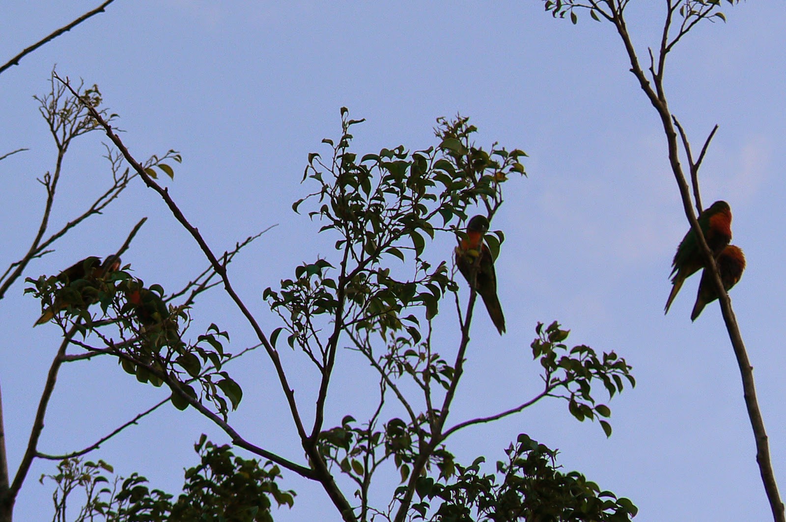
parks and tropical birds nesting in the trees.
Their sound at night is deafening as they vie for roosting rights. It is a maritime city and yachting center. All repairs can be undertaken at its many
shipyards and yacht facilities. The
ethnic mix is largely SE Asian, Japanese, Chinese and Aborigines. The approach to Cairns has many islands that
are designated Aboriginal land and areas of the coastal mainland have been
designated aboriginal territory. One has
to seek permission to land and visit these areas.
It is the
first city where one sees an aboriginal presence and many Torres Strait
Islanders. While we were there they had
an Aboriginal Culture and Awareness Festival at one of the spacious parks in
the city. We saw Torres Strait Islanders
dancing and recreating scenes from their past.
Sadly, there just isn’t that much left of the past to carry on into the
future. Also, there was an International
Ukulele Festival that brought the most famous musicians from distant places.
One of the
only things that Cairns lacks is a beach.
The River and approaches are mud flats and shoals. These are extensive and a channel has been
dredged through them for access to the port.
To make up for this deficiency, the City has made a beautiful lagoon
type swimming pool that children and adults can enjoy. The River harbors crocodiles so any swimming
there is out of the question. We are now
entering a part of North Queensland that has extensive mangrove fringed reefs
and beaches. It’s quite surprising how
these mangroves can survive and flourish in a salt water environment.
So we
departed Cairns on July 12th for Thursday Island in the Torres
Straits: 450 nm North. Cairns is the last major city on the
Queensland coast. In fact, it’s the last
of anything including telephone and internet access. The Great Barrier Reef starts to close in
closer to shore but the shipping lanes are well marked with light houses and
reef markers. Navigationally, it’s not
difficult and we are able to sail without motoring. Most “yachties” try to day-hop and anchor at
night. It becomes increasingly more
difficult to find suitable anchorages that aren’t rolly or uncomfortable. Some
all-nighters are inevitable to reach a good safe anchorage. I have never minded sailing at night other
than the fact that it’s lonely, damp and chilly.
The coast
from Cairns to Cooktown has great tropical beauty and ruggedness. The mountains come right to the sea bringing
their rainforests close enough for the sailor to see. This is high mountainous land with no access
whatsoever. Much of it has been designated
a National Park and the Aborigines have traditional land claims upon it. Many of the areas on the map show “All
Aboriginal Land”. As we sail further
North, the Great Barrier Reef undergoes a change from continental islands
surrounded by reefs to low lying coral reefs.
The first has hills and solid land while the second is coral fringed
with or without mangroves. Many are only visible during low tide. Given their shape and geographical position,
some provide a lee during developed Trade Winds. The Trade Winds are starting to blow out of
the SE with regularity 15-25 kts. There
are days when the WX forecast gives a strong wind warning with the Trades
blowing 30-35 kts. Because we are
sailing downwind, 20-25 kts of wind on the stern is not unpleasant and the
Great Barrier Reef keeps most swell out.
The only swell is a wind generated one by the Trade Winds. If they drop, the seas go down quickly. Mostly, we are sailing with a 5-7’ following
sea. This downwind sailing is quite
relaxing. We have been carrying only a
“headsail” and making 6+ kts effortlessly as long as the wind stays above 15
kts which keeps the sail full and drawing.
Another way is to sail “wing and wing” which means that the Mainsail is
carried on the lee side and the jib or headsail is poled out on the windward
side to keep it full and drawing. Having
the mainsail out gives more speed but complicates matters when it comes to
tacking and course changes. I prefer the
headsail but, when long distance voyaging without course changes, “wing and
wing” is the better option.
As we sail
North and the Trade Winds increase in strength and regularity, we will arrive
in the Torres Straits witch, reputedly, is one of the windiest places in the
world.
July 12,
2013 Saturday
The first
night out of Cairns we spent at Low Islets (16-22.8’ S x 145-33.7’ E). These are about 35 nm Nw of Cairns and
provide a reasonable over night anchorage.
We found the anchorage to be “rolly” but well protected. Wind like water has fluid
characteristics. Whenever a well
developed Trade Wind is blowing from the SE, an easterly swell will develop and
come around into the anchorages even though they are well protected from the
SE. Additionally, the current will set
the vessel beam on to this easterly swell and make it uncomfortable. The ideal is to find a deep indentation in a
reef, island or land that will protect you from this easterly swell. It is those places that the yachtsman seeks
out and, usually, finds another yacht there.
July 13,
2014 Sunday Cape Bedford 118 nm North of
Cairns
In 1770,
Captain Cook on his vessel “Endurance” made a preliminary survey of the North
Queensland Coast and named many of the capes and anchorages that we will be
passing. He was an extraordinary
navigator and seaman and one is awed by his accuracy of positions for the time
period.
We weighed
anchor at 0912 hrs and set sail for Cape Bedford (15-14.1’ S x 145-17.8’ E)
which is 70 nm NW of the Low Islets. The
winds were from the SE at 15 kts with a 3-4 ft sea. Cape Bedford provides a secure anchorage in
shoaling water with very good holding.
It is unique along the North Queensland Coast for its escarpment which
wraps around a conspicuous plateau. This
area is designated “aboriginal land” and belongs to the Hope Vale
Aborigines. It’s a scenic area with
sandy beaches and totally desolate other than the aboriginal settlement further
inland. These aborigines were
Christianized by Pastor Swartz, who took over the mission station at eighteen
years of age after his predecessor was eaten. He lived among the Hope Vale
Aborigines for sixty years. There were
and still are no communications on this part of the coast. We arrived at 2130
hrs and dropped anchor in quiet part of the bay in 24 ft of water on a muddy
bottom. It’s interesting that many of
the reefs and mainland anchorages have sandy beaches or coral but muddy bottoms
mixed with sand and shells that provide excellent holding. During the night the Trade Winds developed
into a near gale and started to blow 25 kts gusting to 30 kts. We remained in the anchorage for the following
day.
July 15,
2014 Tuesday Cape Bedford to Cape
Flattery 25 nm
At 1200 hrs
the wind started to ease so we heaved up anchor and set sail for Cape Flattery
(14-57.2’ S x 145-18.4’ E) which is about 25 nm North from Cape Bedford. It’s another secure anchorage with good
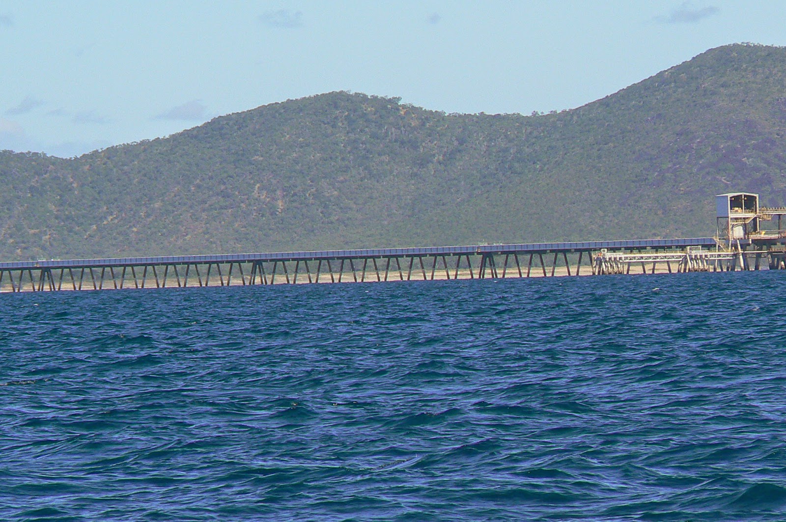
holding. There is a Japanese – owned
silica sand strip mining operation off this cape. They have been mining the silica sand since
1968 so there are general facilities at
their community plus telephone and internet communications. As it worked out, this was the last outpost
where we were able to the Australian telephone company “Telstra” for accessing
the internet. There is nothing
outstanding about Cape Flattery other than the possibility of going ashore to
the Japanese commissary or making a telephone call.
July 16,
2014 Wednesday Cape Flattery to Ninian
Bay 60 nm
We got
underway at 0730 hrs this morning for Ninian Bay (14-20.9’ S x 144-36.0’ E). It’s just another stop on the Northward voyage
to the Torres Straits. There is nothing
remarkable about this bay other than the fact that, in addition to the muddy
bottoms, we start to experience dense sea grass. Where this is found there will
be Dugongs. These are the Australian and
South Pacific version of the Manatee. On
some of the South Pacific islands they are still hunted for food but protected
in Australia. We didn’t see any. We caught a 6 lb Spanish Mackerel today on a
local plug we bought in Bowen.
July 17,
2014 Thursday Ninian Bay to Cape Melville and Bathhurst
Head in Princess Charlotte Bay.
We heaved up
anchor at 1012 hrs today for a relatively short sail to Cape Melville. It was a beautiful day for sailing with SE
Trades at 20 kts with 4 ft seas astern.
Upon entering Bathurst Bay, which is a Dugong Sanctuary, the sailing was
so great in the bay that we decided to sail on to Bathurst Head (14-16.2’ S x 144-11.3’ E) which is about 15
nm in the next bay which is called Princess Charlotte Bay. A unique feature of Cape Melville is that it
consists of hugh boulders stacked upon each other. At 1715 hrs we dropped
anchor near an aboriginal settlement but still well offshore because of the
shoaling water. It was a very peaceful
night at the anchorage with very little wind.
The following day we would find out why.
July 18,
2014 Friday Bathurst Head (Princess Charlotte Bay) to
Morris Island 60 nm.
We got an
early start this morning because we had
to make 60 nm, hopefully, before nightfall.
The winds were very light from the South – Southeast: less than 10
kts. At first, I thought it was because
we were in the wind shadow of the mountains but things didn’t improve as we
made slow progress out of the bay. We
ghosted along at 2-3 kts for several hours and then at 1230 hrs the wind died
out completely so we were becalmed. Just
before that we caught another 6 lb Spanish Mackerel. These fish are good eating!! I started reviewing Alan Lucas’ “Cruising The
Coral Coast” and found the following comment: “Being at the bottom of Princess
Charlotte Bay from where there is nearly one hundred miles of land to the
windward (during a southeast trade wind), the area experiences a form of
‘inland weather’. That is, the trade
wind will lift almost completely by late evening so that the entire night is
calm or, at the most, caressed by a light southerly. And this is true even when there is a strong
wind blowing with gusts reaching 30 knots on the coast.”
We stayed
becalmed until 1454 hrs when the wind came up out of the East at 10 kts and
then veered into the ESE to 20-25. We
didn’t make Morris Island (13-29.3’ S x 143-43.3’ E) until 2242 hrs at
night. I would have been a delightful
island to walk around but time constraints to reach the Torres Straits by July
25th necessitated a miss on this one.
July 19,
2014 Saturday Morris Island to Night Island 21 nm
We heaved up
anchor at 0812 and got underway to Night Island which is only 21 nm North. Another great day of sailing with the Trades
blowing 15-20 kts and seas running about 6 ft on the stern. Night Island (13-10.7’ S x 143-34.4’ E) is a
peanut- shaped mangrove cay that offers fair protection against the
Trades. It has a resident population of
Torres Island pigeons which fly in from the mainland (only 3 nm away), at dusk,
by the thousands. The whole island
vibrates with the cacophony of these birds which are all white with
black-tipped wings. With the haunted
‘hooing’ sound of the birds and a beautiful sunset, it was a great evening to
be there. One of the reasons for not
going ashore in these remote places is that they are crocodile infested. We have a an inflatable dinghy and ‘crocs’
have attacked these in the past. These
animals are protected under Australian law and haven’t been hunted since the
early 1970’s so they are on the increase and one has to be cautious. They seem to have no problem swimming 20 to
30 nm offshore and inhabiting the reefs and mangroves that are found there.
July 20,
2014 Sunday Night Island to Portland Roads 42 nm
We got
underway this morning at 0800 hrs enroute to Portland Roads (12-35.6’ S x
143-24.4’ E). It’s a small outpost of
Europeans about 150 nm south of Thursday Is.
A moderate to strong Trade Wind sends an easterly swell into the bay
which causes various degrees of rolling.
We were lucky that the Trades were only blowing about 15 kts so we had
very little rolling. Once again, we
didn’t go ashore since there is very little there: a sailor needs a bar to be
enticed to go ashore! We’re starting to
get near the goal post of the Torres Straits.
July 21,
2014 Monday Portland Roads to Cape Grenville 50 nm
0700
hrs: up with the anchor and off to Cape
Grenville (11-57.4’ S x 143-12.1’ E).
The Trades are blowing 15-20 kts with 6 ft seas and the sailing is
thrilling. This a safe and secure
anchorage which adds comfort and ease to the voyaging sailor. It will be one of the last secure anchorages
before making the Escape River about 72 nm to the North. Dropped anchor in Margaret Bay (Cape
Grenville) at 1600 hrs in 20 ft water depth with 110 ft chain out.
July22,
2014 Tuesday Cape Grenville to Mount Adolphus Is 90 nm
We decided
to get a really early start this morning to make the Escape River before
dark. With that in mind we got underway
at 0100 hrs in the wee hrs of the morning.
So far we have spearheaded the Sail2Indonesia Fleet because we left
Cairns a few days earlier but they have caught up with us and we are travelling
in a staggered out pattern together.
This 0100 hrs departure is not to compete but to have a relaxing sail to
the Escape River. We arrived at the
entrance to the Escape River at 1230 hrs, and much to my dismay, found that the
River was still ebbing. WE had strong
Trades at 20-25 kts and 7’ seas so I didn’t want to go across the bar which has
reduced depths and should never be crossed during an ebb. With this in mind, I decided to continue on
to Mt Adolphus Island (10-38.3’ S x 142-38.7’ E) which is about 20 nm to the
North and offers good protection and water depth. We are now entering the Torres Straits where
the tidal streams are strong and when they set against a developed Trade Wind
the seas heap up to 8-10 ft. So it was
for a while but then I came in on the flood and started to make 7.0 kts. At 1648 hrs we crossed over the top of
Australia at Latitude 10-42.9’ S x 142-39.1’ E). That’s a long haul to get here! We dropped anchor at Mt. Adolphus anchorage(10-38.3’
S x 142-38.7’ E) at 1748 hrs and watched a beautiful sunset with a ‘ green
flash’. Most people think this is
something extraordinary but the fact is that once one starts to observe sunsets
they are quite frequent. It all depends
on atmospheric conditions.
July 23,
2014 Wednesday Mt. Adolphus Island to Horn Island (10-35.8’
S x 142-14.4’ E). Everything here is now
a matter of calculating tides and tidal streams. There is a height difference between the
Coral Sea to the East and the Arafura Sea to the West. The Torres Straits are a fulcrum point
between these tidal differences and undergo big tidal swings with currents in
excess of 8 kts at times although the average is about 3-5 kts. With this in mind, we got underway at 0730
hrs with a flood tide and light SE’ly
winds 10-15 kts. A really beautiful sail
in perfect conditions for entering Horn Is.
Port Kennedy on Thursday Is is the main port and administrative center
for the Torres Strait Islands, however, it is exposed to the Trades so all
vessels anchor over on Horn Island which offers a lee and calm conditions. That is where we are at enjoying peaceful
conditions in an anchorage that has 4 kts of current ripping through it. Everyone carries a VHF handheld radio when
motoring in the dinghy to the dock and back: just in case the motor quits.
Thursday Is
isn’t much: a small town with a few
supermarkets, stores and
restaurants. Since it is the
administrative center for Northern Australia, the clearing out process is done
here. We will do this on Monday July 28
for Saumlaki, Indonesia: 670 nm West. We
plan on heaving up anchor around 1100 hrs and depart on the flood tide. We will not have internet for posting until
we find something in Indonesia.
The Torres
Strait Islanders are an interesting mixture of Micronesian, Melanisian,
Japanese and Caucasian. Their colors
range from light brown to Papua New Guinea Black. In truth, their culture has been destroyed
and they retain only the remnants of an ancestral past. They are good seamen and fishermen. The pearling and trochus shelling industry
was active here until the late
60’s. The islands abound in lobster and
other kinds of fish. There is a ferry
that that carries passengers from Horn Is to Thursday Is every 45 minutes and
costs about $ 14 US. Horn Is has almost
nothing other than fueling, water, a small grocery store and, most importantly,
a pub.
The
Sail2Indonesia Fleet is anchored here and most will depart on Monday 28 July or
Tuesday 29 July. For the next 6 days
communications will be on Sailmail.
Saumlaki,
Indonesia : 7-59.0 S x 131-18’ E.

.JPG)
.JPG)
.JPG)
.JPG)


.JPG)

.JPG)
.JPG)
.JPG)

.JPG)
.JPG)
.JPG)