July 23, 2013 Tuesday
Meandering all over the arc of the anchor and hearing the anchor chain grating on the short coral is nerve wracking! Magogai Bay is quite deep and I had 210' of anchor chain in 56' of water depth. With williwaws boxing the compass and intermittent periods of calm, two nights were enough in this lovely place. We heaved up anchor at 0930 hrs on July 23rd and sailed over to Koro (17-16.5' s; 179-21.6 E) which is about 32 nm bearing 068 T deg. from Makogai. I decided to go out the NE pass (Daveta Loboni) for which I had Way Points but the chart was inaccurate and need an offset. There is a new navigation technique developed and being used by yachties which incorporates Google Earth views which are placed over an existing area of a chart and then a "transparency" can be created on top of the chart and the offset can be seen and corrected. The GE2KAP program then allows the navigator to slide the chart to the Google Earth view and "voila" the offset and correct chart view are there. All this doesn't mean much to most of you but it's brilliant to a navigator! I'm always impressed with the amount of savvy, knowledge and computer programming skills that are out here amongst the yachties. The end result of all this was that we navigated through the reef system flawlessly.
Dere Bay (17-16.5' S; 179-21.6' E) in Koro has four strong mooring balls that are available to visiting yachts. This makes it easy for a yacht to pick one of these up instead of anchoring. The moorings are anchored to the seabed with special helix anchors which provide a safe anchoring system for the yacht. The only thing required of the yacht is to pick up a floating line attached to a mooring ball and make it fast to the bow cleats on the yacht. After that the yacht swings with the wind direction.
Koro is a rather strange place. It appears that there was a frenzy of building and marketing with the selling of lots to Americans, Kiwis and Ozzies. The Dere Bay Resort was built and, due to the extensive reef system, has the longest pier in Fiji to get out to deeper water. The Resort seems to have all the amenities vacationing landlubbers and property owners demand but there just aren't many people around. The Resort was only open during the evenings and if a meal was wanted it had to be ordered a day in advance. The island seems to be eco-conscious and an American reality show was filmed in one of the bungalows that was built for the filming. Later there was feuding and law suits from all the participants over property rights and ownership. Today, the bungalow is abandoned and in shambles with no one able to buy or sell the property: a lawyer's orgasm!
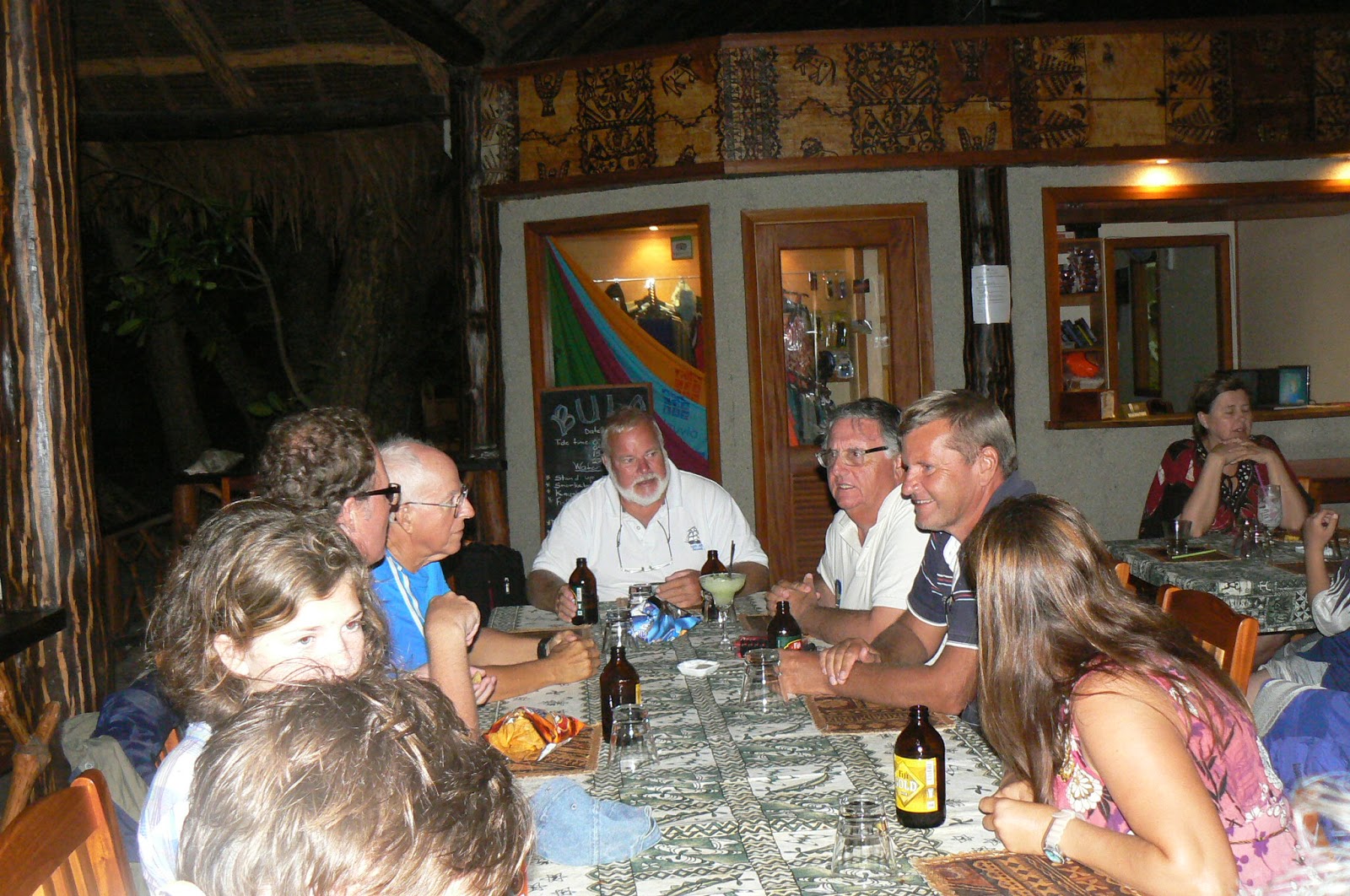
We have been travelling in the same direction with another boat "Catharpin Blue" since Suva. It's an Island Packet 420 and lovely she is. Anyway, we signed up a day in advance for the evening meal and met an American ophthalmologist and his partner. They were sporting a bottle of Patron Tequila and generous is sharing. Patron encourages speech and stimulates the imagination even if the senses are dulled. A good time was had by all.
We managed to get over to the local school and donate a box of books that were picked up in Opua, NZ for remote schools in the islands. The headmaster was an interesting Fijian who had a progressive outlook on getting his brightest students into higher education. Unfortunately, the school only had one computer for all the grades. I'm not seeing much of a trickle down effect from the Resort or those big homes on the hill that drink "sun-downers" every evening and ogle the Sun. Be that as it may, every Fijian has a million dollar smile and a personality to go with it. Absolutely a fascinating and beautiful country!
Saturday, July 27, 2013
LELEUVIA ISLAND TO MAKOGAI ISLAND FIJI
July 21, 2013 Sunday
The "bogiwalu" (8 nights of strong enhanced Trade Winds) has finally started to blow itself out. Last night we had our final "lovo" (baked in an underground oven) of fish, chicken and assorted vegetables at the wonderful Leleuvia Resort. This is a really low scale place catering to backpackers and cost conscious clientele. Nevertheless, it is run by a very experienced staff under the management of one of Fiji's outstanding resort management families: The Philips Family. On Leleuvia, it appears that the management has been placed in the hands of a younger brother, Colin Philip and his lovely wife. What a magnificent job they are doing! This resort is so low keyed that everyone in treated like "friends". They will make it a priority to know your names and escort you to and from the dinghy dock. One will not find the rich and famous here and, thankfully, there are no super yachts.
The sailing distance from Leleuvia to Makogai (17-26.4' S; 178-57.2' E) is about 30 nm. With light S x W'ly winds and a favorable outgoing current in the Moturiki Channel, it's a six hour sail over to Makogai Is. We departed at 0800 hrs and arrived at 1430 hrs. This island is notable because it was used as a leper colony from 1908-1969. Today there are only seven families (30 people) living in the former homes that were occupied by the staff overseeing the management of the leper colony. These homes are made from wood brought from New Zealand and still in remarkably good condition. Most of the former concrete structures are in ruins. The last of the lepers were transferred to a facility in Suva, Fiji in 1969.
The Makogai Leprosarium was set up and run by the The Missionary Sisters of the Society of Mary. Many of these dedicated sisters were from France and Switzerland. At its peak, the leprosarium housed almost 5000 patients from all over the Pacific. There is a graveyard that has almost 1500 including some of the dedicated sisters. What a magnificent calling and job these missionary sisters did in attending to the outcasts of society. There is a brief film clip of a ship landing at Makogai sometime in the late 1940's. It is bringing relatives and loved ones for a once a year visit to the lepers. What stands out is the cleanliness and attention that was given to the lepers. These Sisters were the dedicated Saints of the Lepers. There is a book published in 1978 by the Leprosy Trust Board of New Zealand titled: "Makogai - Island of Hope". It was written by Sister M. Stella who was one of the caregivers on the island. Google Makogai and view the British Film Clip and listen to the reporter's Oxford English!
Today, all that remains of this great leprosarium are the wooden structures that housed the general staff and facilities. There are seven separate families living in the old wooden buildings. Makogai is now owned by the Fijian govenment and has an aquaculture farm that raises and distributes the giant clams and Hawkesbill turtles that are endangered. It's fascinating to see the process whereby the giant clams are raised in long cement holding tanks and then moved to different units as they mature. Makogai Bay has several giant clams that measure over six feet in length. The mouths of the clams are quite colorful and vary in colors. Many of the old leper hospital beds have been thrown into the bay and are used to house cages for the giant clams. The government official in charge of the Wildlife and Fisheries program is knowledgeable and friendly. He spent quite a bit of time with us touring all the facilities and the ruins of the leper colony. They are still using the old Lister four cylinder generator engine that powered the leper colony in the 1940's. It runs four hours per day: 7-9 am and 7-9 pm. There are no televisions on the island and the children from the three villages are taken to school by boat. Like so many of the Pacific islands, Makogai is very beautiful. If I had one complaint it would be that the anchorage is plagued by "williwaws" (strong gusty katabatic winds) that descend from the mountains surrounding the bay. These winds cause the boat to meander all over the place which is quite disconcerting.
Thursday, July 18, 2013
Our sail from Suva to Beqa,and on to Leleuvia .
 |
| Solstice under sail leaving Suva on to the island of Beqa. |
 |
| We are anchored in Vaga Bay in front of the Naiseuseu village. |
 |
| The Naiseuseu village. |
 |
| Another picture of Naiseuseu village. |
 |
| Being greeted by the villagers as we dinghyed in. |
 |
| We were invited to a meal at Ben and Maria's house. |
 |
| Our meal consisted of wonderful Mahi-Mahi,Cassava, Noodles , Rice, Limes for the fish , and Mango juice. It was very tasty. |
 |
| Marilyn and Sam from Catharpin Blue , Don and I. |
 |
| Ben and his children visiting us on SSolstice. |
 |
| Children of the village. They love to have their picture taken. |
 |
| Mushrooms growing on the trees. |
 |
| We moved from Vaga Bay to Malumu Bay |
 |
| Catharpin Blue anchored in Malumu Bay. |
 |
| Solstice anchored in Malumu Bay. |
 |
| Entrance to Malumu Bay. |
 |
| An overnight sail from Malumu Bay to Leleuvia where we have been for here for a week. It a beautiful place to bee to wait for a good weather window to move on. |
 |
| A beautiful resort with palm trees and white sandy beaches. |
 |
| Leleuvia |
 |
| Don letting out more anchor chain. |
 |
| Fisherman coming back from fishing. |
 |
| Meeting up with other yachting friends. |
 |
| Brother and sister, Steve and River with Mom and Dad Amy and Arthur on Morning Glory also doing a cirrcunvation. |
 |
| This was Lovo night, it was quite a feast. Lovo is food cooked in an in ground pit. |
 |
| The food consisted of fish, chicken,, poisson cruie., taro leaves. different salads, and etc. |
 |
| This also includes a band and |
 |
| Lots of Kava. |
 |
| Dancing the Fijian two step. |
 |
| More Kava |
 |
| The Bar. |
 |
| This pig is from the Naiseuseu village. He was possing for us. |
.
 |
| Catharpin Blue and Solstice anchored at Vaga Bay in front to naiseuseu village. |
 |
| A little waterfall coming out of the Mangoroves. |
 |
| Ben.s Nephews who where showing us the different plants and flowers along the shore of Naiseuseu village. |
Monday, July 15, 2013
LEVUKA ON OVALAU ISLAND- THE FIRST CAPITAL OF FIJI
July 15, 2013 Monday
The Trade Winds have been blowing quite strongly (25-30 kts) from the SE over the last few days and will continue until Friday of this week. I've strung out 35 fathoms of chain (210') in a water depth of 8 fathoms (40'). The bottom is all sand and we're holding well. The protecting reef on Leleuvia is allowing only a 1' chop so all is comfortable. One of the reasons for choosing Leleuvia was the proximity of Levuka and the ability of taking a ferry or fast boat to the old capital.
We arranged transportation by fast boat with the Leleuvia Resort and left at 1100 hrs for Levuka (17-41' S; 178-51' E) which is about 12 nm to the North through reef passages not accessible by yacht. It took about 40 minutes to get there. The fast boat had a four stroke 225 hp Yamaha outboard and we flew along in deep water but had to slow down and pick up the motor (hydraulically) in the shallow reefs. Levuka was the first capital of Fiji and seems to have been chosen because of its wide reef entrance and the ability of the Fijian canoes to enter on a beam reach when coming or going. There are leading lights in line at 263 T degrees. I saw a fixed marker in the pass and it is a ship channel so entering or departing would be no problem. It is not a popular yacht anchorage because it is exposed to the prevailing winds and heavy seas pass over the reef that separates the anchorage from the ocean. Additionally, it puts the yacht on a lee shore with indifferent holding. Furthermore, the dinghy landings can be wet. The anchorage has an odoriferous smell from the local fish factory.
Due to tribal warfare and conflict, the British were able to scheme, knive, and bamboozle the local Chiefs until the Islands were conceded to them in 1874. Many of the colonial buildings and precolonial buildings still exist in Levuka. It seems to be the intent of the Fijian government to keep the town as a living museum of the past. The English did it on the cheap so we are not talking or seeing great beauty here. The town looks like something out of a third rate Italian spaghetti movie with its store fronts and irregular side walks. Take away the paved roads and make them dust and one could imagine gunslingers from our own fictionalized history. Essentially, the town is made up of wooden buildings and corrugated galvanized tin roofs. A few stores and fewer selections for fresh produce with a humble restaurant or two are about it. The various denominational churches have quite a bit of charm. The beauty of it all would be the wonderful Fijian people who always great you with a "bula" and a smile. Given their past history as fierce cannibals, I keep thinking that the friendliness and smiles were always there: Today I greet you, tomorrow I eat you.
If the weather would cooperate, I would be willing to anchor in the harbor for a few days before moving along to more remote islands and scenic beauty. Nevertheless, Levuka is worth a visit for its historic value. We left Levuka at 1530 hrs and arrived back in Leleuvia at 1615 hrs.
Saturday, July 13, 2013
BEQA TO LELEUVIA ISLAND
July 11, 2013
At 1330 hrs we weighed anchor and set sail for either Gau or Leleuvia Is. The deciding factor was the wind direction and course to be made. Still sailing with" Catharpin Blue" which is an Island Packet 44' cutter rigged yacht. She doesn't point as well as the Valiant 40 so was difficult for her to make the 069 T deg course to Gau which was about 70 nm away. Additionally, the local chief on Gau was sick and dying so the village was saddened by this. We thought that it would be better to sail for Leleuvia Is which was about 60nm away. Now that you have downloaded Google Earth, you can follow the passage from Malumu Bay (18-23' S; 178-09' E) to Leleuvia Is (17-45.5' S; 178-43.0 E). Fiji is made up of two big islands (Viti Levu and Vanua Levu) with another 300+ smaller ones. We are sailing on the southernmost island of Viti Levu and working our way North to Savusavu on Vanua Levu.
Our main interest in choosing Leleuvia Is is a good safe anchorage with access to the old Capital of Levuku on Ovalau Is which is 13 nm to the North. It was home to Fiji's earliest European Settlement and the country's first capital. It has maintained all the old historic colonial buildings and atmosphere. This is done by using one of the ferry boats that depart daily from Leleuvia for Levuka. I would have preferred to anchor in Levuka but it is exposed to the prevailing SE Trade winds and puts one on a lee shore even thought it is protected by a reef system.
We arrived five nm South of the Moturiki Channel at 0130 hrs on June 12th and dropped all sails to lie ahull waiting on first light. No sailing is done at night in inland Fijian waters due to coral studded entrances and anchorages. At 0815 we entered the Moturiki Channel and preceded to the designated anchorage off Leleuvia. There is no "sevusevu" offered here in Leleuvia since there is no Chief: it's a resort.
Dropped anchor in position 17-48.5' S; 178-43.0' E at 0936 hrs. Leleuvia is a resort facility that hosts backpackers, young adults and itinerants. The rich and famous do not frequent the place but it is well organized and has a bar, restaurant, small huts and other living facilities. We are enjoying our stay and waiting on weather to ferry over to Levuku for a day of sightseeing and shopping for veggies and food.
The wind has been blowing strongly out of the SSE 20-25 kts for the last two days. We can go ashore to the bar/restaurant but would not leave the boat for a day excursion into Levuka. As soon as we get a weather break, we'll do it.
The water here should make for great snorkeling but the wind has caused a murkiness that diminishes their underlying beauty. There is a live coral reef and oyster farm very near to our anchorage and I'm waiting of the water to clear up. Yesterday I dove on our boat and cleaned the port side bottom which only had a small amount of green algae growing on the bottom. Our Micron 66 anti-fouling is working well.
Environmentally, Fiji is well aware of the importance of preserving their most precious resources. All resorts are practicing some form of recycling but financial constraints limit more of what could be done. We, too, try to do our share in keeping plastic, batteries, glass, aluminum cans and other non-biodegradable consumables aboard until we find a proper trash receptacle.
Last night we were at the restaurant which was having a "lovo" for the evening meal. The "lovo" is food that is cook in an underground oven: fish, meat, chicken and vegetables. Some form of underground oven is found throughout the South Pacific islands. It provides the most tasty, succulent and perfectly cooked food possible. This resort has recreated one of the ancient Fijian meeting houses for their central bar/restaurant. The central supporting posts are over 100' high and a traditionally thatched roof that is watertight: quite impressive. The resort is very will managed and organized. There were Fijian musicians from the neighboring island of Moturiki playing a mixture of American country and traditional Fijian: four guitars, two ukuleles and a gut bucket. The gut bucket was particularly interesting as it was made up of a plywood box, a movable stick holding a single string that could be moved to be in tune with the cording structure of the song. Nothing too sophisticated with the music: four cords in, mostly 3/4 or 4/4 time. The rendition of HankWilliam's "Jambalaya, Crawfish pie, File gumbo" was wonderful. The Kava (yaquona) was flowing freely throughout the evening amongst the musicians and guests. It is made in a huge wooden bowl called a "tanoa" which is carved out of a single piece of wood. These "tanoas are big and can hold a few gallons of the mixture. The yaqona is prepared and shared from this wooden bowl in half coconut shells (bilo) which are highly polished. Everyone drinks from several of these in a communal fashion. I drank enough of the yaqona to get a "buzz" but the effects are very mild: slight numbing of the lips, tongue and throat which goes away rather quickly. There is some perception change that is very slight but not alcohol related. I have been told that if one drinks too much the legs get wobbly. I guess it has very mild sedative and anesthetic properties. At far as I can tell, it doesn't lend itself to the same type of thing as alcohol. There were a lot of people drinking it and no one appeared impaired. The taste is slightly bitter and it looks like muddy water. There is a little ceremony that goes along with each bowl of kava: one clap of the hand and the bowl is handed to you and you toss it down in a single gulp and then clap three times. Need another one? Clap one more time! This cupped clap has its own sound: the palms are cupped so that they make a hollow "thumping sound" (cobo in Fijian).
SUVA TO BEQA
July 6, 2013
After 19 days in Suva, it's time to move on to the outlying islands and participate in the rural life of Fijian villagers. Many of the transits are weather dependent as they involve sailing close hauled into the wind. It is amazing how the highs and lows that are coming off Australia and New Zealand affect the Fijian weather pattern. Also, the weather to the North of Fiji has a great influence. All this produces heavy rain and strong wind on the Eastern side of the island. We try to pick weather windows for comfortable sailing.
Our first choice for venturing outside of Suva was Beqa. This island is about 30 nm to the South of Suva and is home to the famous Beqa Fire Walkers. They inhabitants are members of the Sawau tribe and can walk bare foot across blazing hot rocks! How and Why is steeped in legend: an encounter with a spirit god by one of their great ancestors saw the exchange of the captured god's freedom for the power over fire. Today these fire walkers participate in religious ceremonies that have become tourist attractions. One of the most famous fire walking ceremonies takes place in Suva sometime at the end of July or August and lasts 10 days. Unfortunately, we will not be in the area for this event. We never did see or inquire about fire walking ceremonies on Beqa since they are a staged tourist attraction.
We left Suva at 0900 hrs on July 6 and arrived in Vaga Bay, Beqa (18-24' S; 178-06' E) at 1500 hrs. This is a small community of several hundred people who are very friendly and accommodating. We made our "sevusevu" (presentation of Kava) to the local chief and wondered around the village. We were taken into one of the homes and invited to attend their church the following morning which was Sunday. Approximately 85% of Fijians are Methodist; 12% Catholic; the rest Hindu and Muslim. There are no cars or roads on Beqa: It's all done by boat or foot. The children are taken to school in a boat or walk if it's not too far. We went to the village on the following morning but the church services were scheduled in another village so we didn't have a chance to hear the wonderful music that all these islanders create with their voices and instruments. Our hosts provided us with a typical Fijian meal of fish, rice, cassava, noodles and mango juice: very well prepared and delicious. In the villages Fijians eat with their hands but we were given the opportunity to follow suit or use forks. A finger bowl was provided for washing the hands after the meal.
The host family was invited to visit our yacht later on in the day and we arranged to pick them up at 1500 hrs. We have been sailing with another vessel named "Catharpin Blue". They too participated in the meal and entertainment for the host family. We would have stayed longer in the village and anchorage but it was plagued by katabatic winds that rush off the high mountains and hit the boat with force causing it veer and swing around in circles. The holding was good but we were close to reefs and didn't feel secure enough to stay on and take hikes into the mountains and other villages.
On June 8th we weighed anchor at 1335 hrs and decided to circle the island counterclockwise to Malumu Bay in the Northern part of the island. The guides we had consulted indicated a beautiful bay with safe anchorage and sapphire waters. It is a long narrow entrance into an extinct volcano crater and quite stunning in scenery and surrounding mountains. We dropped anchor at 1630 hrs in position (18-23' S; 178-09' E). Unfortunately, it, too, is plagued with violent katabatic winds that come in gusts boxing the compass. Once again, the holding is great in volcanic sand and mud but the gusts are continuous and disconcerting. There were no villages in Malumu Bay; only some kind of tourist resort called Lalati. The heavy rains turned the bay into a muddy brown but eventually cleared to a jade green. It wasn't enticing enough to go swimming. Two days of this was enough to consider another part of Fiji so on July 11th we heaved up anchor and set sail for Gau with the option of going to Leleuvia Is. In the end we opted for Leleuvia Island (18-48.5' S; 178-43' E). The wind and seas were in the right sector for making passage: SE 12-15 kts; seas 4'.
We are trying to take snap-shot pictures of the charts and anchor positions to make it easier to locate where we are but the best thing would be to download Google Earth and zoom in to the positions given. All one has to do is put the positions in Google Earth and it will take you right there. I use snap-shots of Google Earth to confirm that the charts are accurate and offset any errors. Google Earth is an amazing tool. The world is at your finger tips!
Thursday, July 4, 2013
Family, friends and a few more of Suva.
Some of these pictures where left out when I posted the first pictures and they are not in order but please enjoy anyway,


 |
| Our daughter Misty and their dogs Miles and Bailey. |
 |
Our grandson Parker with Christmas toys. |
 |
Fijian school girls. |
 |
Flowers seen and sold at the open market on Saturdays. |
 |
More beautiful flowers. |
 |
and more |
 |
Beautiful mackerel sky. |
 |
| Chinese fishing boats all rafted together. |
 |
What looks like a small volcano seen from our yacht in Suva. |
 |
My painted fabric of sea life. |


 |
What Don and I eat for breakfast, papaya, watermelon and pineapple, yummy. |
 |
Our good friends Deloris and Scott. |
 |
Our grand daughter at Christmas. |
Subscribe to:
Posts (Atom)